| P number: | P208612 |
|---|---|
| Old photograph number: | A08690 |
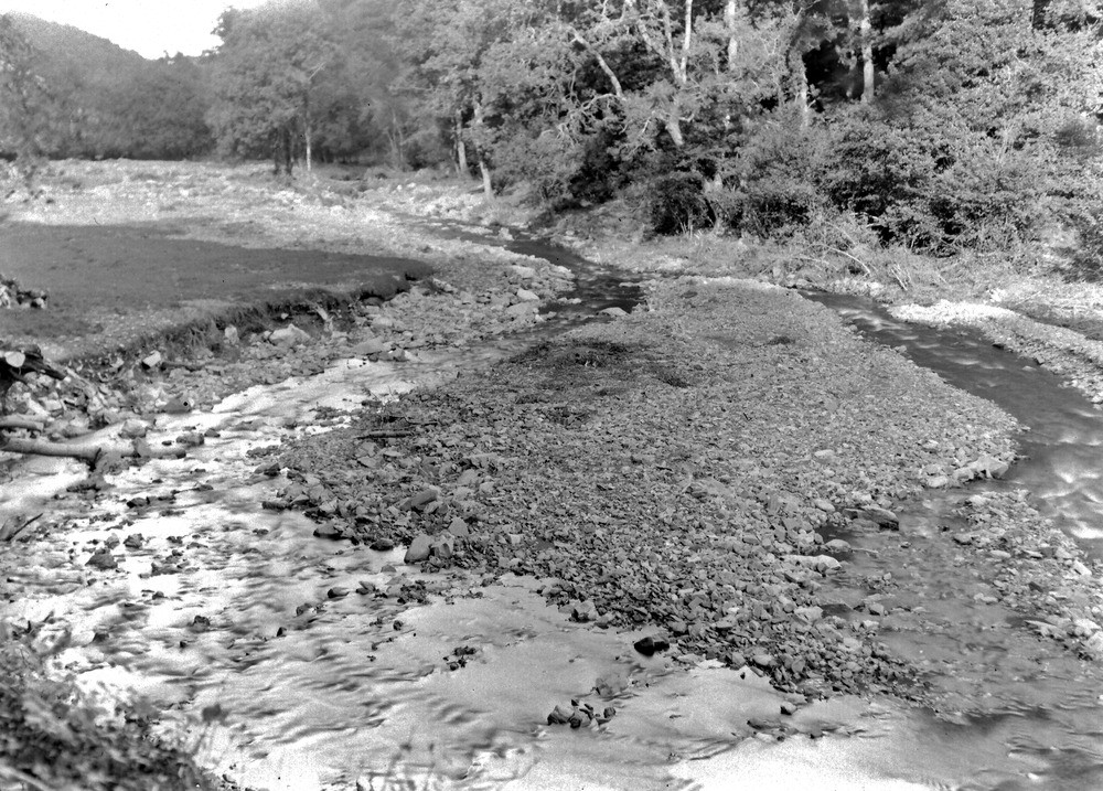
| Caption: | West Lyn River - Ham Linhay, 675 yd. WNW - NW of Stock Castle (earthworks). Looking NE (downstream). |
| Description: | West Lyn River - Ham Linhay, 675 yd. WNW - NW of Stock Castle (earthworks). Looking NE (downstream). North Exmoor floods, 1952. The original meander elbow has been further incised (left) destroying a barn built on head. The river meanwhile obliterated its right-hand bank and greatly enlarged the bed in this direction. Note also the boulder spread on the alluvium surface further downstream (background). |
| Date taken: | Sat Sep 27 00:00:00 BST 1952 |
| Photographer: | Rhodes, J. |
| Copyright statement: | Crown |
| X longitude/easting: | 271500 |
| Y latitude/northing: | 147500 |
| Coordinate reference system, ESPG code: | 27700 (OSGB 1936 / British National Grid) |
| Orientation: | Landscape |
| Size: | 318.88 KB; 1000 x 717 pixels; 85 x 61 mm (print at 300 DPI); 265 x 190 mm (screen at 96 DPI); |
| Average Rating: | Not yet rated |
| Categories: | Unsorted Images, Geoscience subjects/ Landforms, river/ Floods |
Loading...
Loading...
Reviews
There is currently no feedback