| P number: | P208604 |
|---|---|
| Old photograph number: | A08682 |
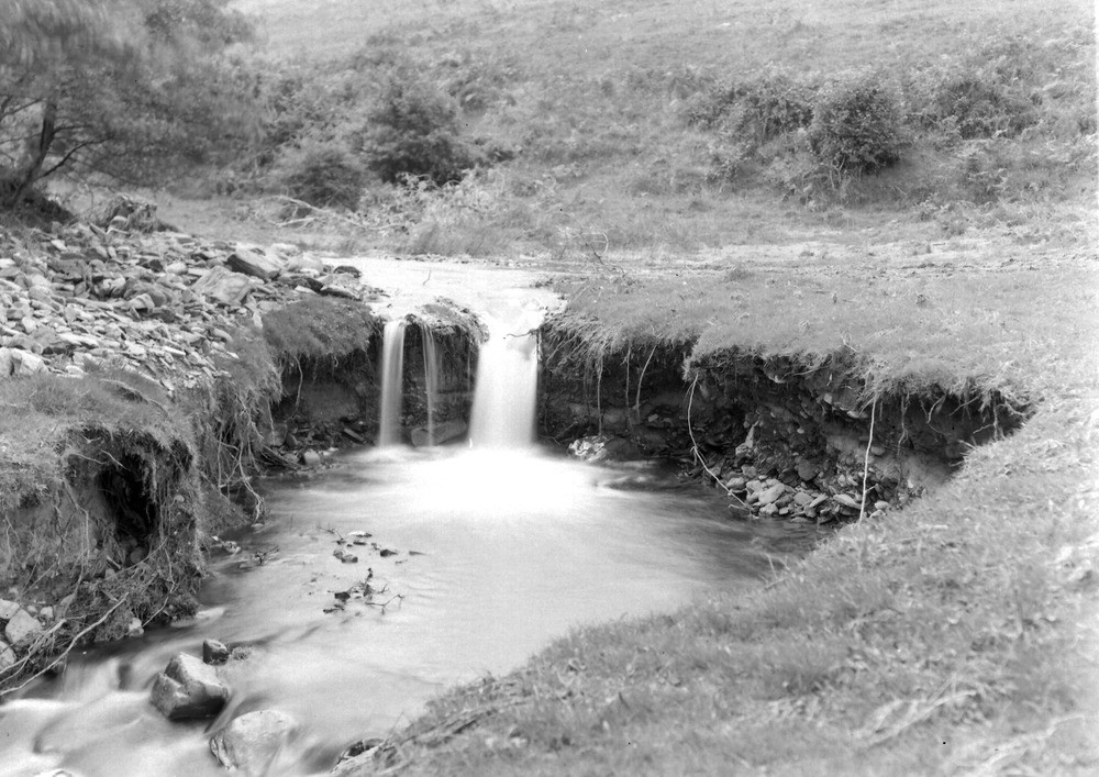
| Caption: | West Lyn River, 475 yd. S. of Sparhanger Farm and 900 yd. NW of Furzehill Bridge. Looking SW. |
| Description: | West Lyn River, 475 yd. S. of Sparhanger Farm and 900 yd. NW of Furzehill Bridge. Looking SW. North Exmoor floods, 1952. A new view channel being cut back in alluvial gravel. The original course was blocked just above this point. |
| Date taken: | Sat Sep 27 00:00:00 BST 1952 |
| Photographer: | Rhodes, J. |
| Copyright statement: | Crown |
| X longitude/easting: | 272500 |
| Y latitude/northing: | 145500 |
| Coordinate reference system, ESPG code: | 27700 (OSGB 1936 / British National Grid) |
| Orientation: | Landscape |
| Size: | 233.80 KB; 1000 x 707 pixels; 85 x 60 mm (print at 300 DPI); 265 x 187 mm (screen at 96 DPI); |
| Average Rating: | Not yet rated |
| Categories: | Unsorted Images, Geoscience subjects/ Landforms, river/ Floods |
Loading...
Loading...
Reviews
There is currently no feedback