| P number: | P208597 |
|---|---|
| Old photograph number: | A08675 |
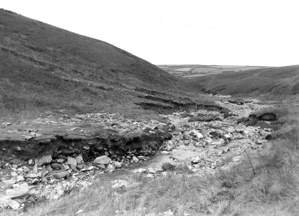
| Caption: | West Lyn River, 250 yd. S. of the point at which the county boundary crosses the river. Looking N. (downstream). |
| Description: | West Lyn River, 250 yd. S. of the point at which the county boundary crosses the river. Looking N. (downstream). North Exmoor floods, 1952. Intense view-board erosion in the upper reaches of the valley causing widening of the bed. Note small landslips in the middle distance in the right-hand band. |
| Date taken: | Fri Sep 26 00:00:00 BST 1952 |
| Photographer: | Rhodes, J. |
| Copyright statement: | Crown |
| X longitude/easting: | 272500 |
| Y latitude/northing: | 143500 |
| Coordinate reference system, ESPG code: | 27700 (OSGB 1936 / British National Grid) |
| Orientation: | Landscape |
| Size: | 227.58 KB; 1001 x 725 pixels; 85 x 61 mm (print at 300 DPI); 265 x 192 mm (screen at 96 DPI); |
| Average Rating: | Not yet rated |
| Categories: | Unsorted Images, Geoscience subjects/ Landforms, river/ Floods |
Loading...
Loading...
Reviews
There is currently no feedback