| P number: | P208596 |
|---|---|
| Old photograph number: | A08674 |
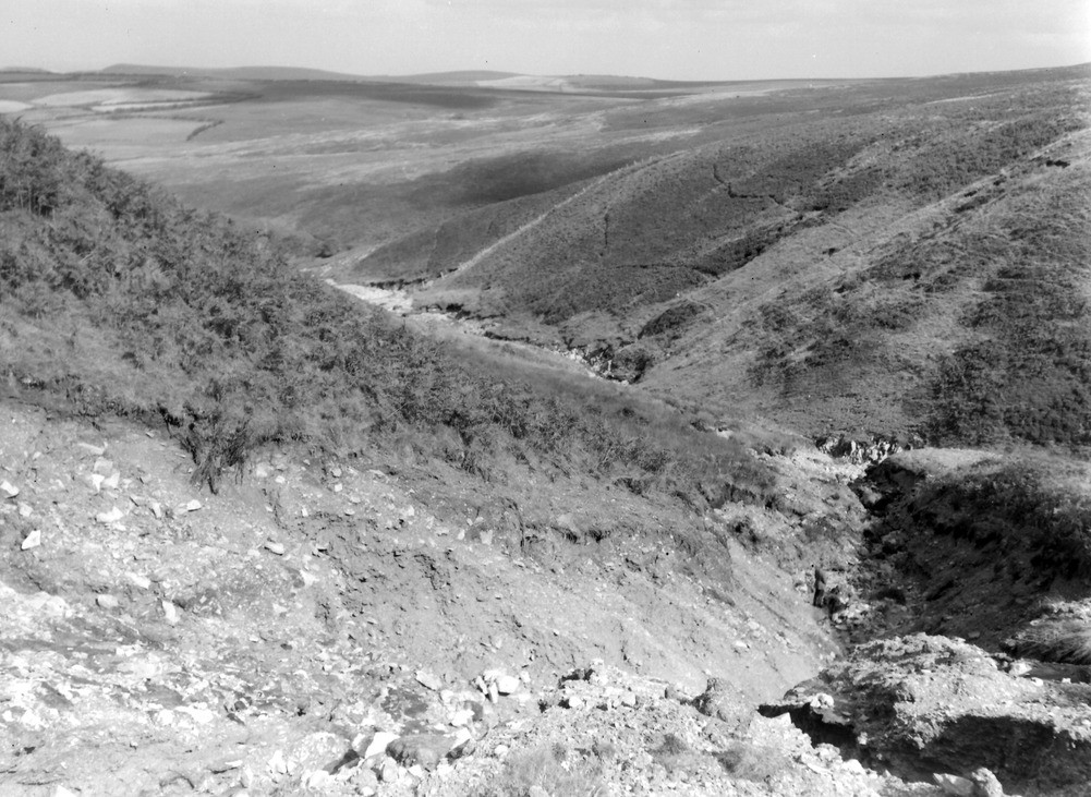
| Caption: | West Lyn Valley, 550 yd. SSW of point where county boundary crosses the West Lyn River. Looking NE. |
| Description: | West Lyn Valley, 550 yd. SSW of point where county boundary crosses the West Lyn River. Looking NE. North Exmoor floods, 1952. Ravining in small side stream exposing up to 15 ft. of head on banded shale and sandstone. The same stream figures in A8671, A8672, and A8673. |
| Date taken: | Fri Sep 26 00:00:00 BST 1952 |
| Photographer: | Rhodes, J. |
| Copyright statement: | Crown |
| X longitude/easting: | 272500 |
| Y latitude/northing: | 143500 |
| Coordinate reference system, ESPG code: | 27700 (OSGB 1936 / British National Grid) |
| Orientation: | Landscape |
| Size: | 256.48 KB; 1001 x 731 pixels; 85 x 62 mm (print at 300 DPI); 265 x 193 mm (screen at 96 DPI); |
| Average Rating: | Not yet rated |
| Categories: | Unsorted Images, Geoscience subjects/ Landforms, river/ Floods |
Loading...
Loading...
Reviews
There is currently no feedback