| P number: | P208594 |
|---|---|
| Old photograph number: | A08672 |
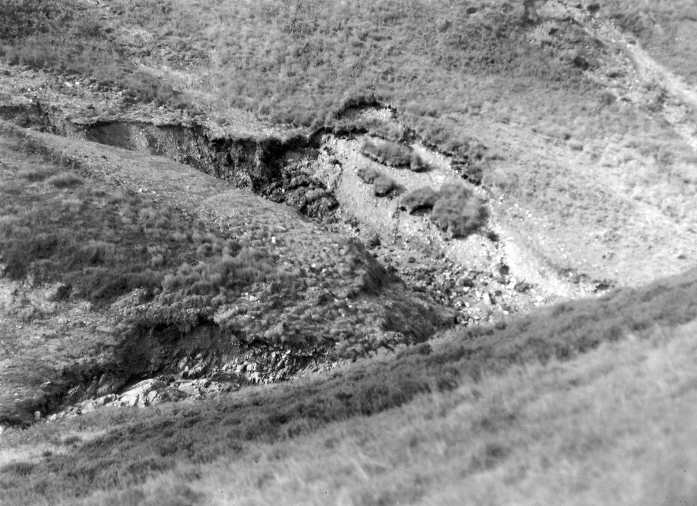
| Caption: | West Lyn Valley, 450 yd. S. of the point at which the county boundary crosses the West Lyn River. Looking NW. |
| Description: | West Lyn Valley, 450 yd. S. of the point at which the county boundary crosses the West Lyn River. Looking NW. North Exmoor floods, 1952. Ravining in peat (1? ft.) and head (15 ft.) in small side stream, showing the peat slipping downwards independently of the head. This side stream also figures in A8671, A8673, and A8674. Note solid rock (sandstone and shale) in the bed of the mainstream. |
| Date taken: | Fri Sep 26 00:00:00 BST 1952 |
| Photographer: | Rhodes, J. |
| Copyright statement: | Crown |
| X longitude/easting: | 272500 |
| Y latitude/northing: | 143500 |
| Coordinate reference system, ESPG code: | 27700 (OSGB 1936 / British National Grid) |
| Orientation: | Landscape |
| Size: | 242.46 KB; 1000 x 726 pixels; 85 x 61 mm (print at 300 DPI); 265 x 192 mm (screen at 96 DPI); |
| Average Rating: | Not yet rated |
| Categories: | Unsorted Images, Geoscience subjects/ Landforms, river/ Floods |
Loading...
Loading...
Reviews
There is currently no feedback