| P number: | P208593 |
|---|---|
| Old photograph number: | A08671 |
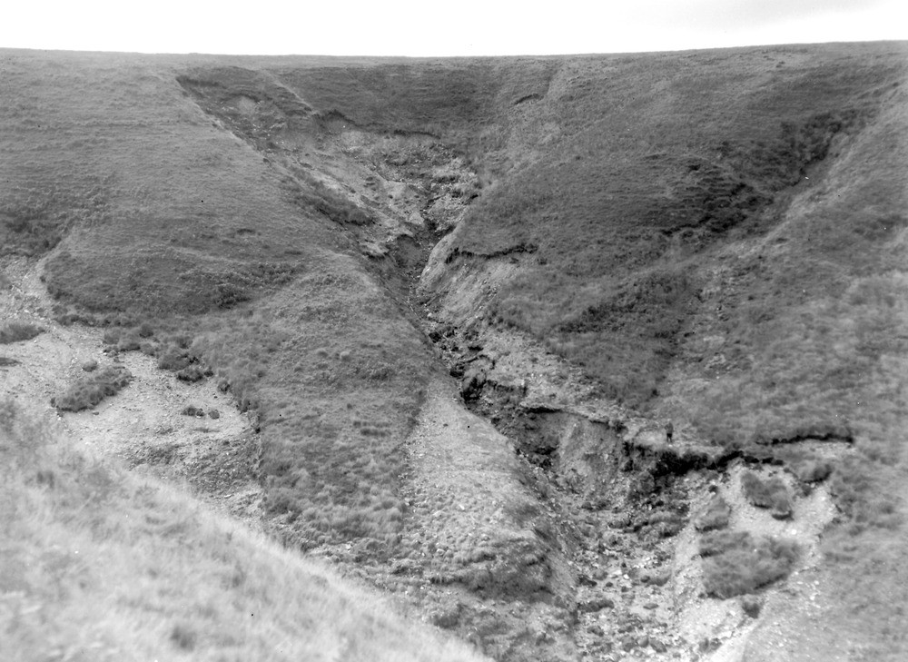
| Caption: | West Lyn Valley, 400 yd. S. of the point at which the county boundary crosses the West Lyn River. Looking SW |
| Description: | West Lyn Valley, 400 yd. S. of the point at which the county boundary crosses the West Lyn River. Looking SW North Exmoor floods, 1952. Intense downcutting occurs in small side stream exposing up to 15 ft. of head resting on banded shale and sandstone. Note shallow landslipping in the main valley to the left, also at the head of the side stream. Peat (1-2? in.) is seen peeling off in various places. The same stream also figures in A8672, and A8674. |
| Date taken: | Fri Sep 26 00:00:00 BST 1952 |
| Photographer: | Rhodes, J. |
| Copyright statement: | Crown |
| X longitude/easting: | 272500 |
| Y latitude/northing: | 143500 |
| Coordinate reference system, ESPG code: | 27700 (OSGB 1936 / British National Grid) |
| Orientation: | Landscape |
| Size: | 226.97 KB; 1000 x 729 pixels; 85 x 62 mm (print at 300 DPI); 265 x 193 mm (screen at 96 DPI); |
| Average Rating: | Not yet rated |
| Categories: | Unsorted Images, Geoscience subjects/ Landforms, river/ Floods |
Loading...
Loading...
Reviews
There is currently no feedback