| P number: | P208584 |
|---|---|
| Old photograph number: | A08662 |
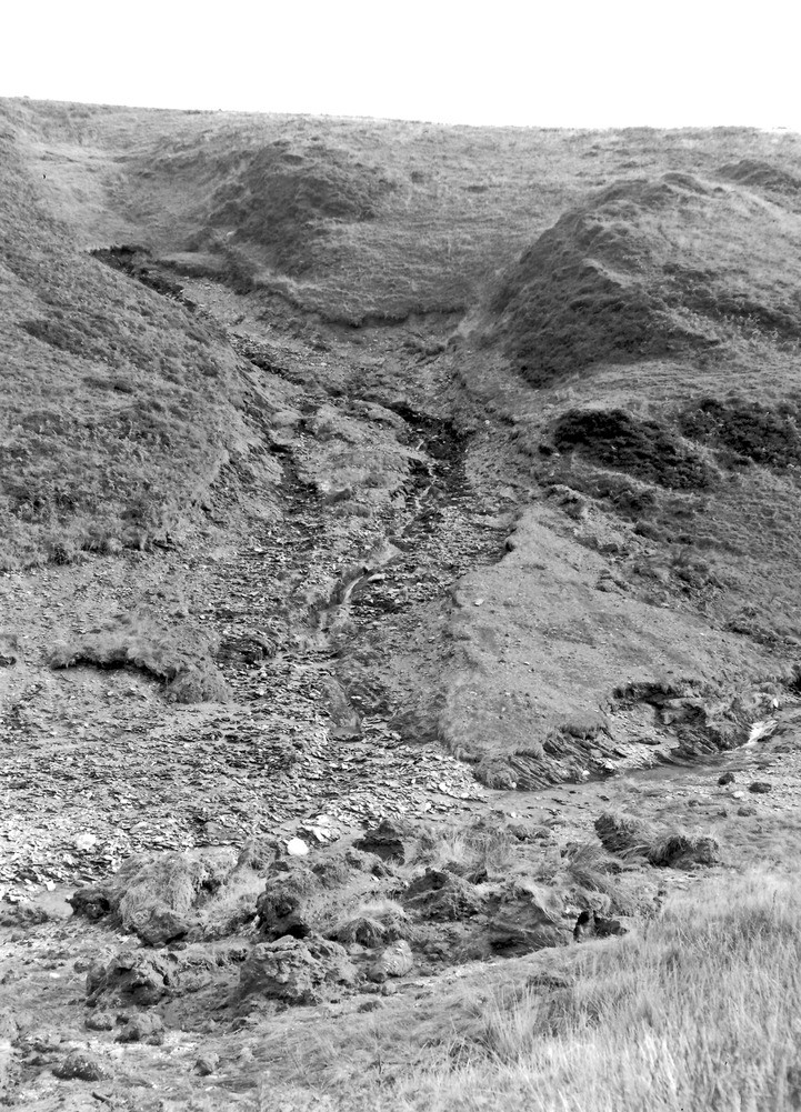
| Caption: | 525 yd. SW of Saddle Gate (county boundary), Thornworthy tributary of West Lyn. Looking SE. |
| Description: | 525 yd. SW of Saddle Gate (county boundary), Thornworthy tributary of West Lyn. Looking SE. North Exmoor floods, 1952. Scouring in small sidestream down to solid shale. There is about 3-4 ft. of peat resting on solid shale at the top but lower down there must have originally been head between the two. Note the peat in the foreground from higher up the mainstream which has been carried partly up the near side of the valley by the force of water for the sidestream. |
| Date taken: | Mon Sep 29 00:00:00 BST 1952 |
| Photographer: | Rhodes, J. |
| Copyright statement: | Crown |
| X longitude/easting: | 271500 |
| Y latitude/northing: | 143500 |
| Coordinate reference system, ESPG code: | 27700 (OSGB 1936 / British National Grid) |
| Orientation: | Portrait |
| Size: | 321.63 KB; 721 x 1001 pixels; 61 x 85 mm (print at 300 DPI); 191 x 265 mm (screen at 96 DPI); |
| Average Rating: | Not yet rated |
| Categories: | Unsorted Images, Geoscience subjects/ Landforms, river/ Floods |
Loading...
Loading...
Reviews
There is currently no feedback