| P number: | P208582 |
|---|---|
| Old photograph number: | A08660 |
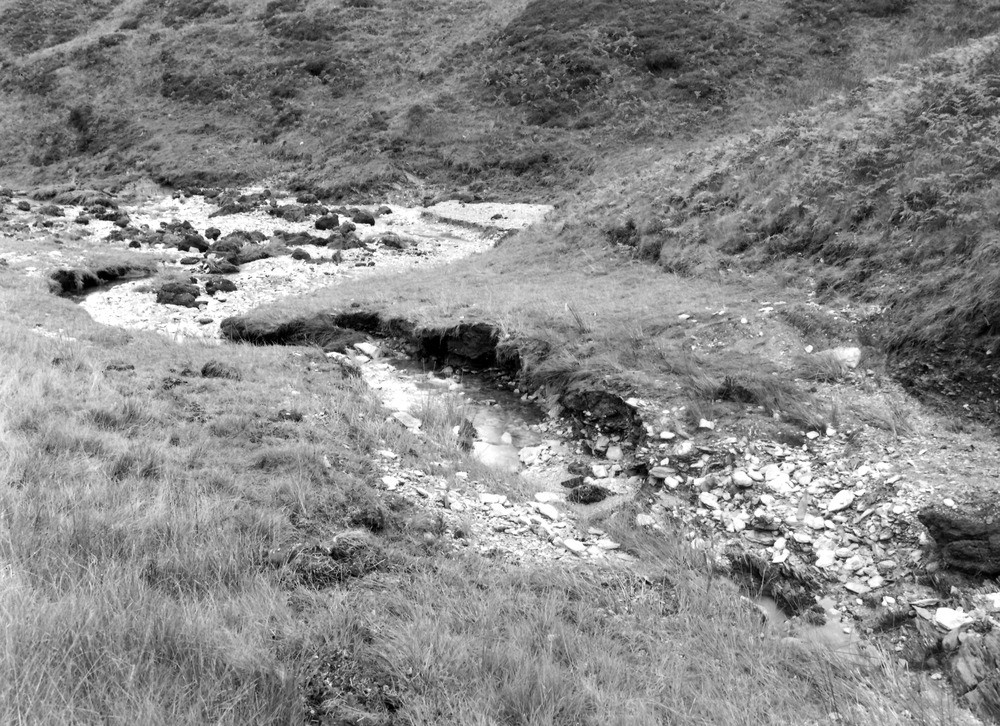
| Caption: | 650 yd. SW of Saddle Gate (county boundary), Thornworthy tributary of West Lyn. Looking ENE. |
| Description: | 650 yd. SW of Saddle Gate (county boundary), Thornworthy tributary of West Lyn. Looking ENE. North Exmoor floods, 1952. The junction of the two source streams of the Thornworthy tributary. Note the crooked peat banks, peat balls, flood marks, slate gravel delta with foreset slope in the further stream bed. |
| Date taken: | Mon Sep 29 00:00:00 BST 1952 |
| Photographer: | Rhodes, J. |
| Copyright statement: | Crown |
| X longitude/easting: | 271500 |
| Y latitude/northing: | 143500 |
| Coordinate reference system, ESPG code: | 27700 (OSGB 1936 / British National Grid) |
| Orientation: | Landscape |
| Size: | 330.42 KB; 1000 x 726 pixels; 85 x 61 mm (print at 300 DPI); 265 x 192 mm (screen at 96 DPI); |
| Average Rating: | Not yet rated |
| Categories: | Unsorted Images, Geoscience subjects/ Landforms, river/ Floods |
Loading...
Loading...
Reviews
There is currently no feedback