| P number: | P208399 |
|---|---|
| Old photograph number: | A08477 |
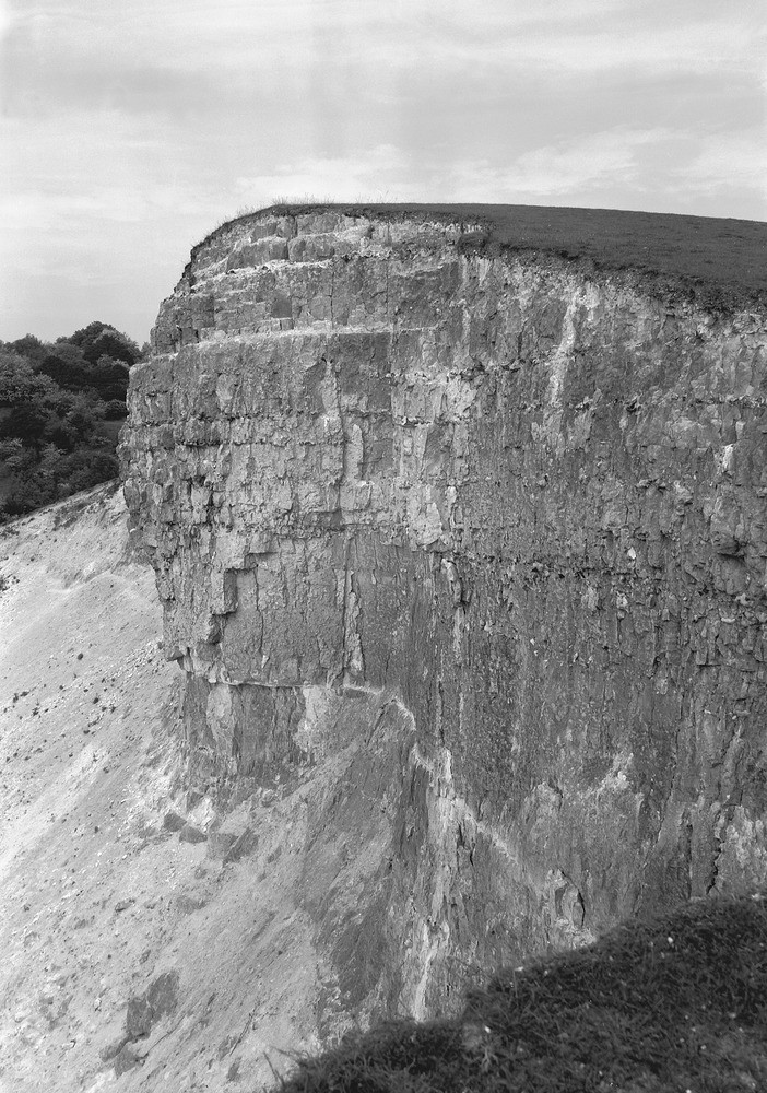
| Caption: | Chalk-pit, near Detling Church, Kent. |
| Description: | Chalk-pit, on Chalk escarpment, 3/4 m. north by west of Detling Church. Looking north-west. Uppermost beds of the Cretaceous Middle Chalk. These beds of hard blocky and nodular Chalk, with bands of flint nodules in the upper part, and occasional marl seams (one is to be seen as a white line near base of the section, and immediately below the overhanging part of the face), belong to the uppermost part of the Middle Chalk, in the zone of Terebratulina lata. The base of the Upper Chalk lies at the top of the section. The Chalk forms high ground in the area, forming the prominent escarpments of the North and South Downs. It is a well-known and highly distinctive Upper Cretaceous rock. It is a pure dazzling white limestone formed largely from the skeletons or coccoliths of planktonic calcareous algae. At the start of the Upper Cretaceous a major transgression left most of Britain covered in warm tropical seas in which the Chalk was formed. |
| Date taken: | Thu Jun 01 00:00:00 BST 1950 |
| Photographer: | Rhodes, J. |
| Copyright statement: | Crown |
| X longitude/easting: | 579100 |
| Y latitude/northing: | 158750 |
| Coordinate reference system, ESPG code: | 27700 (OSGB 1936 / British National Grid) |
| Orientation: | Portrait |
| Size: | 295.85 KB; 702 x 1000 pixels; 59 x 85 mm (print at 300 DPI); 186 x 265 mm (screen at 96 DPI); |
| Average Rating: | Not yet rated |
| Categories: | Unsorted Images, Geoscience subjects/ Economic geology/ Cement and lime, limestone quarries and chalk pits |
Loading...
Loading...
Reviews
There is currently no feedback