| P number: | P208366 |
|---|---|
| Old photograph number: | A08444 |
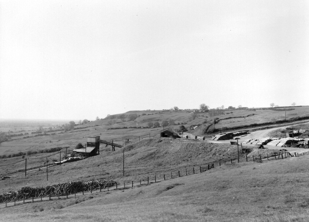
| Caption: | A point about 550 yd. W. of NW of Nettleton Top, near Nettleton. Looking S. |
| Description: | A point about 550 yd. W. of NW of Nettleton Top, near Nettleton. Looking S. View looking south along the Cretaceous escarpment. The Nettleton Mine buildings are in the foreground. The profile in the background begins with the long irregular slope of the Kimmeridge Clay (on the right), rising up to the rounded bluff of the Spilsby Sandstone and, above it, the flat-topped platform of the Tealby Limestone which rises gently eastward (to the left) up to the Chalk lands. |
| Date taken: | Sat Jan 01 00:00:00 GMT 1949 |
| Photographer: | Rhodes, J. |
| Copyright statement: | Crown |
| X longitude/easting: | 510700 |
| Y latitude/northing: | 398100 |
| Coordinate reference system, ESPG code: | 27700 (OSGB 1936 / British National Grid) |
| Orientation: | Landscape |
| Size: | 180.11 KB; 1000 x 721 pixels; 85 x 61 mm (print at 300 DPI); 265 x 191 mm (screen at 96 DPI); |
| Average Rating: | Not yet rated |
| Categories: | Unsorted Images |
Loading...
Loading...
Reviews
There is currently no feedback