| P number: | P007710 |
|---|---|
| Old photograph number: | A12613 |
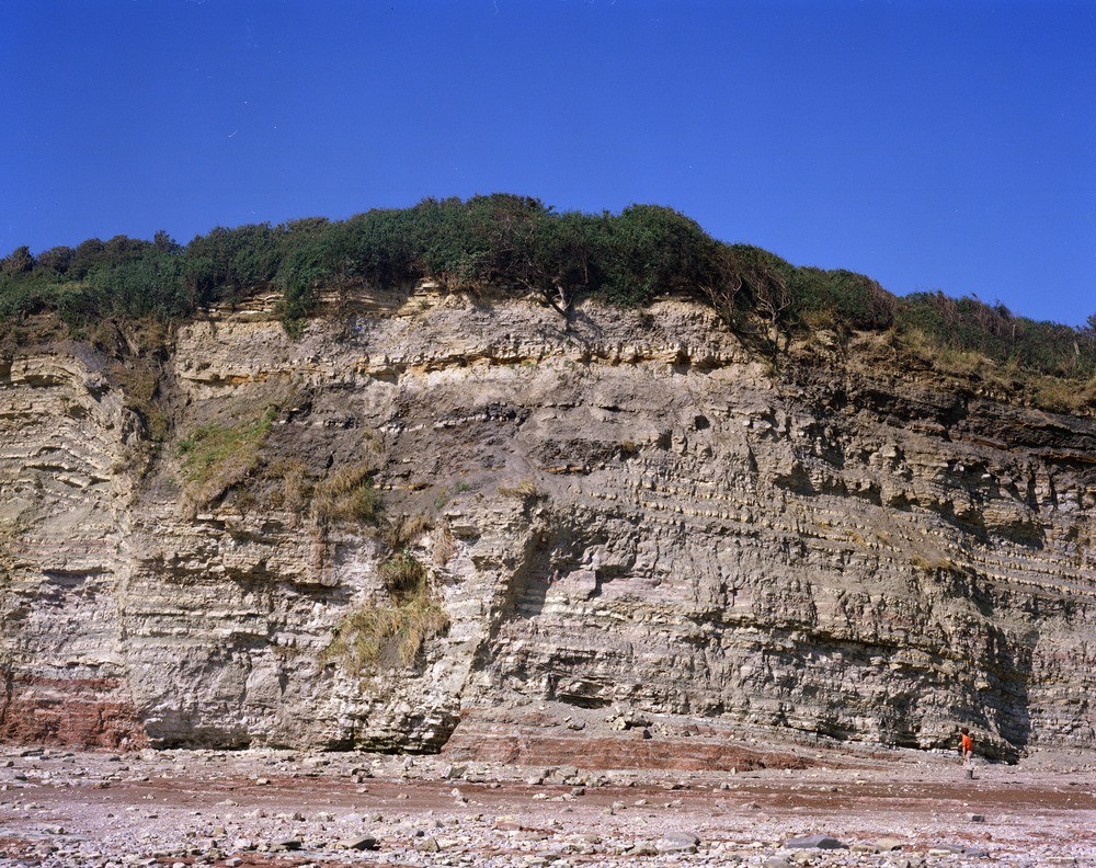
| Caption: | Coastal cliffs 1200 m. N. of Lavernock Point. Looking W. |
| Description: | Coastal cliffs 1200 m. N. of Lavernock Point. Looking W. Trough fault in Triassic strata, Lavernock Point, Penarth coast. Fault block capped by Lower Lias 'Ostrea beds'. The 20 m. cliff exhibits Penarth Group on Tea Green Marl and Red Marl. Fault downthrown c. 7 m. |
| Date taken: | Sat Jan 01 00:00:00 GMT 1977 |
| Photographer: | Jeffery, C.J. |
| Copyright statement: | NERC |
| Acknowledgment: | This image was digitized with grant-in-aid from JIDI the JISC Image Digitization Initiative |
| X longitude/easting: | 318700 |
| Y latitude/northing: | 169450 |
| Coordinate reference system, ESPG code: | 27700 (OSGB 1936 / British National Grid) |
| Orientation: | Landscape |
| Size: | 356.13 KB; 1000 x 792 pixels; 85 x 67 mm (print at 300 DPI); 265 x 210 mm (screen at 96 DPI); |
| Average Rating: | Not yet rated |
| Categories: | Unsorted Images, Geoscience subjects/ Structural features/ Fault breccia |
Loading...
Loading...
Reviews
There is currently no feedback