| P number: | P007706 |
|---|---|
| Old photograph number: | A12609 |
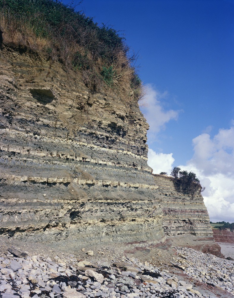
| Caption: | 250 m. N. of Lavernock Point. Looking NW. |
| Description: | 250 m. N. of Lavernock Point. Looking NW. Tea Green Marl in cliff 250 m. N of Lavernock Point. Photograph shows alternating siltstone and mudstone beds overlain by limestone and shale near the top of the formation. The red bed at the base of the left cliff is the 'Pink Bed' 4 m. above the base of the formation which can be seen on the cliff to the right and in photo A12610. Height of cliff 13 metres. |
| Date taken: | Sat Jan 01 00:00:00 GMT 1977 |
| Photographer: | Jeffery, C.J. |
| Copyright statement: | NERC |
| Acknowledgment: | This image was digitized with grant-in-aid from JIDI the JISC Image Digitization Initiative |
| X longitude/easting: | 318710 |
| Y latitude/northing: | 168350 |
| Coordinate reference system, ESPG code: | 27700 (OSGB 1936 / British National Grid) |
| Orientation: | Portrait |
| Size: | 370.89 KB; 788 x 1000 pixels; 67 x 85 mm (print at 300 DPI); 208 x 265 mm (screen at 96 DPI); |
| Average Rating: | Not yet rated |
| Categories: | Unsorted Images, Geoscience subjects/ Sedimentary features/ Bedding-planes |
Loading...
Loading...
Reviews
There is currently no feedback