| P number: | P007705 |
|---|---|
| Old photograph number: | A12608 |
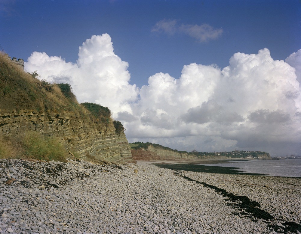
| Caption: | Coastal section from Lavernock to Penarth. Looking N. |
| Description: | Coastal section from Lavernock to Penarth. Looking N. Coastal section from Lavernock to Penarth Head. On the left, Penarth Group black shales overlie Keuper Tea Green Marl and Red Marl with gentle southerly dip. These beds form the southern limb of a small anticline with its axis in the Red Marl seen in the centre. To the right the beds dip gently north into the syncline of Seven Sisters Bay where Lower Lias 'Ostrea beds' cap the cliff. The hill of Penarth in the far right is capped by Lower Lias 'Upper Limestones' downthrown by a fault exposed in the cliffs of Penarth Head. Details of the strata are shown in photographs A12609 and A12610. The foreground is a cobble and pebble storm beach composed predominantly of Lias Limestone. The height of the cliff varies from 8 to 30 metres. |
| Date taken: | Sat Jan 01 00:00:00 GMT 1977 |
| Photographer: | Jeffery, C.J. |
| Copyright statement: | NERC |
| Acknowledgment: | This image was digitized with grant-in-aid from JIDI the JISC Image Digitization Initiative |
| X longitude/easting: | 318730 |
| Y latitude/northing: | 168330 |
| Coordinate reference system, ESPG code: | 27700 (OSGB 1936 / British National Grid) |
| Orientation: | Landscape |
| Size: | 271.52 KB; 1001 x 781 pixels; 85 x 66 mm (print at 300 DPI); 265 x 207 mm (screen at 96 DPI); |
| Average Rating: | Not yet rated |
| Categories: | Best of BGS Images/ Geological structures |
Loading...
Loading...
Reviews
There is currently no feedback