| P number: | P007690 |
|---|---|
| Old photograph number: | A13476 |
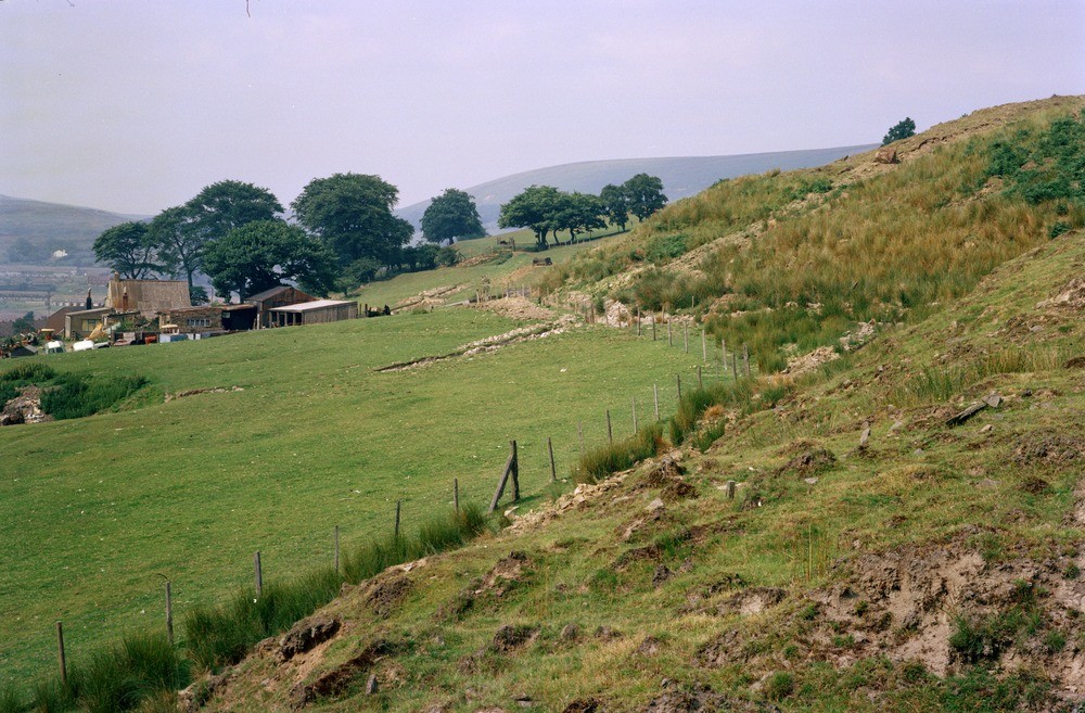
| Caption: | Pentwyn Farm, Blaina. |
| Description: | Pentwyn Farm, Blaina. Toe of East Pentwyn landslip. Near the toe of the East Pentwyn landslip, the debris flow, approx 15 m. in thickness (see photograph A13472) divides into 2 lobes, moving at different rates and separated by the rushy gully on the centre right. The debris flow can be divided into 2 roughly equal areas, an upper part with large 'Pennant' sandstone blocks on the surface (photograph A13472) and a lower part composed largely of Rhondda Beds material with scarce 'Pennant' sandstone debris. At the toe margin, a narrow zone of rushes indicates continual water seepage and lubrication along the sole of the lobe. The flow is advancing over head-covered undisturbed basal Llynfi Beds. A small quarry is present at the centre left. |
| Date taken: | Sun Jan 01 00:00:00 GMT 1978 |
| Photographer: | Pulsford, J.M. |
| Copyright statement: | NERC |
| Acknowledgment: | This image was digitized with grant-in-aid from JIDI the JISC Image Digitization Initiative |
| X longitude/easting: | 320570 |
| Y latitude/northing: | 207470 |
| Coordinate reference system, ESPG code: | 27700 (OSGB 1936 / British National Grid) |
| Orientation: | Landscape |
| Size: | 249.97 KB; 1000 x 657 pixels; 85 x 56 mm (print at 300 DPI); 265 x 174 mm (screen at 96 DPI); |
| Average Rating: | Not yet rated |
| Categories: | Unsorted Images, Geoscience subjects/ Landforms, weathering/ Landslips |
Loading...
Loading...
Reviews
There is currently no feedback