| P number: | P007686 |
|---|---|
| Old photograph number: | A13472 |
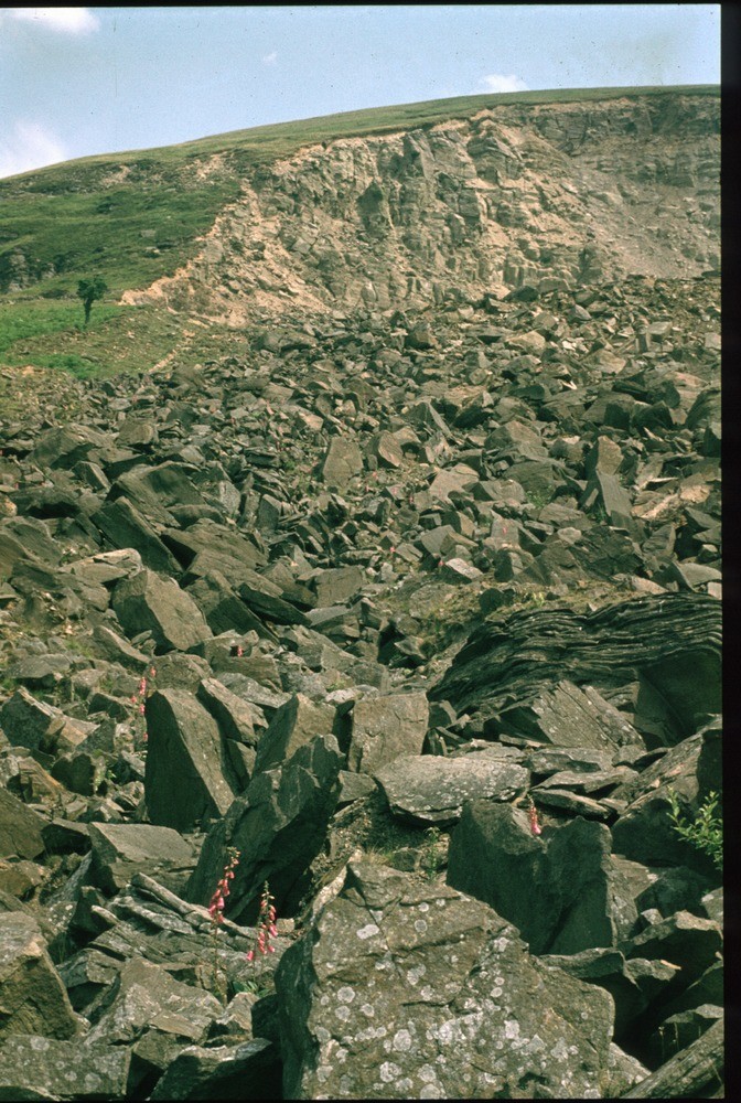
| Caption: | East Pentwyn, near Blaina. |
| Description: | East Pentwyn, near Blaina. Debris flow and back scar of typical 'Pennant' landslip, Blaina. The jumbled mass of large 'Pennant' sandstone blocks on the surface of a large debris flow, 'A', is generated downslope of the back scar of the East Pentwyn slump earth-flow. The debris flow averages 15 m. in thickness and is moving slowly downslope above a lubricated sole. The initial landslip was probably largely translational with little rotational movement. In the back scar, some 15 m. of dark stained 'Pennant' sandstone overlies a thin coal smut, the Cefn Glas, 'B', marking the base of the Hughes Beds. The Brithdir Coal, 'C', at the base of the Brithdir Beds is overlain by 4 m. rusty weathering mudstones, 'D', the 50 m. sandstone crags, 'E', and the 8 m. mudstones, shales and seat-earths, 'F', beneath the Cefn Glas. A discontinuous cover of sandy head, averaging 1 m. overlies the in situ rock. The landslip occurred in 1954. |
| Date taken: | Sun Jan 01 00:00:00 GMT 1978 |
| Photographer: | Pulsford, J.M. |
| Copyright statement: | NERC |
| Acknowledgment: | This image was digitized with grant-in-aid from JIDI the JISC Image Digitization Initiative |
| X longitude/easting: | 320600 |
| Y latitude/northing: | 207500 |
| Coordinate reference system, ESPG code: | 27700 (OSGB 1936 / British National Grid) |
| Orientation: | Portrait |
| Size: | 283.47 KB; 672 x 1000 pixels; 57 x 85 mm (print at 300 DPI); 178 x 265 mm (screen at 96 DPI); |
| Average Rating: | Not yet rated |
| Categories: | Unsorted Images, Geoscience subjects/ Landforms, weathering/ Landslips |
Loading...
Loading...
Reviews
There is currently no feedback