| P number: | P208027 |
|---|---|
| Old photograph number: | A08105 |
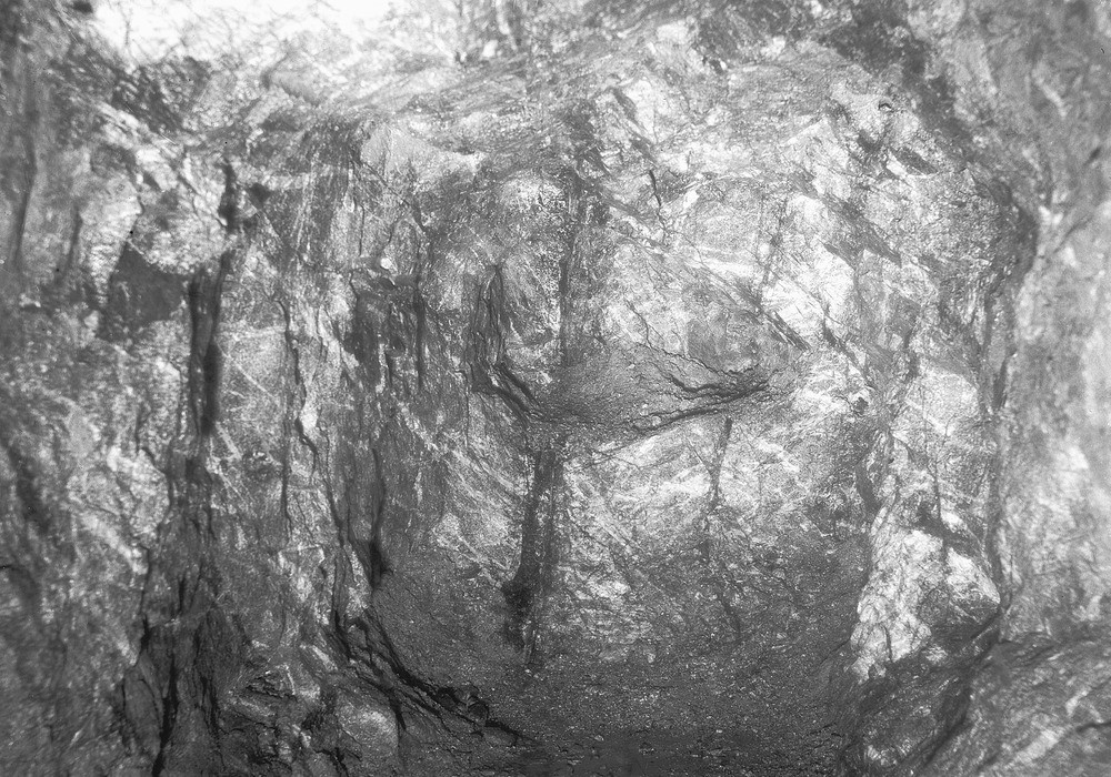
| Caption: | No. 2 Lode, South Crofty Mine, Carn Brea, Cornwall. |
| Description: | South Crofty Mine, Carn Brea. South Crofty Mine: No. 2 Lode, Robinson's Section. A branch on north side of No. 2 Lode, 310 fm. Level, Robinson's Section. The branch in granite country rock consisting mainly of chlorite-tourmaline peach is seen, nearly vertical, in the end of the level. The horizontal quartz veins, here inclined, are seen to be faulted by the branch lode. 'Lode' is a term probably derived from the verb 'lead' and applied by early miners to formations which might guide or lead to ore. In south-west England faulting has played a major part in governing the pattern of lode development and many hypothermal (high temperature) and mesothermal (intermediate temperature) veins can be directly related to normal faults. A general fracture pattern which eventually produced the channels for the mineralizing fluids probably developed during the initial period of folding and granite intrusion. Later relaxation of the regional pressures and shrinkage caused by the cooling granite then reactivated the fractures causing block movement and possibly gravity-slumping. |
| Date taken: | Wed Aug 01 00:00:00 BST 1945 |
| Photographer: | Rhodes, J. |
| Copyright statement: | Crown |
| X longitude/easting: | 168500 |
| Y latitude/northing: | 41500 |
| Coordinate reference system, ESPG code: | 27700 (OSGB 1936 / British National Grid) |
| Orientation: | Landscape |
| Size: | 339.09 KB; 1000 x 700 pixels; 85 x 59 mm (print at 300 DPI); 265 x 185 mm (screen at 96 DPI); |
| Average Rating: | Not yet rated |
| Categories: | Unsorted Images, Geoscience subjects/ Economic geology/ Metalliferous mining, tin |
Loading...
Loading...
Reviews
There is currently no feedback