| P number: | P007658 |
|---|---|
| Old photograph number: | A13444 |
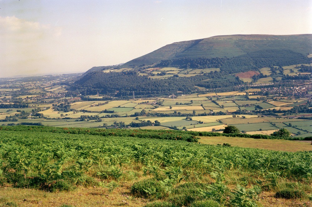
| Caption: | Near Abergavenny. |
| Description: | Near Abergavenny. The Blorenge, looking from Sugar Loaf. Looking towards the Blorenge. The south-westerly dip of the strata can be clearly seen in the pale green streak near the top of the hill. This streak marks the outcrop of the basal Carboniferous Limestone. The highest part of the hill is in basal Coal Measures strata. The wide prominent bench towards the base of the hill has a thin veneer of glacial drift and is thought to be an alp-type feature marking a former preglacial valley position. |
| Date taken: | Sun Jan 01 00:00:00 GMT 1978 |
| Photographer: | Pulsford, J.M. |
| Copyright statement: | NERC |
| Acknowledgment: | This image was digitized with grant-in-aid from JIDI the JISC Image Digitization Initiative |
| X longitude/easting: | 326900 |
| Y latitude/northing: | 216700 |
| Coordinate reference system, ESPG code: | 27700 (OSGB 1936 / British National Grid) |
| Orientation: | Landscape |
| Size: | 277.34 KB; 1000 x 663 pixels; 85 x 56 mm (print at 300 DPI); 265 x 175 mm (screen at 96 DPI); |
| Average Rating: | Not yet rated |
| Categories: | Unsorted Images, Geoscience subjects/ Landforms, river/ Valleys |
Loading...
Loading...
Reviews
There is currently no feedback