| P number: | P207942 |
|---|---|
| Old photograph number: | A08020 |
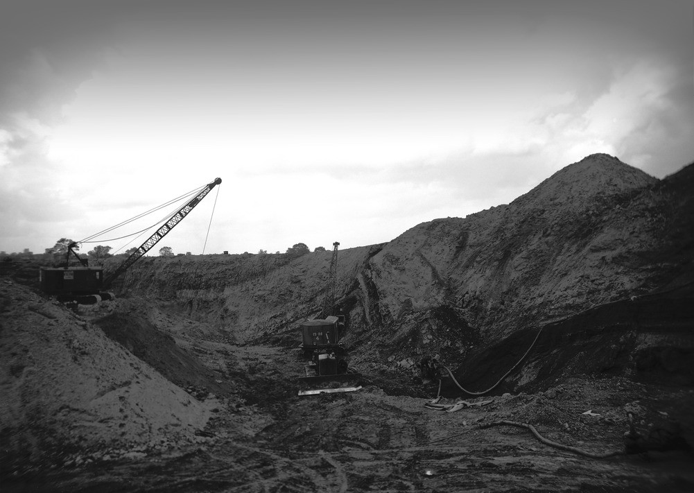
| Caption: | Opencast coal, folding in New Red Sandstone and Coal Measures. Redborough Farm opencast site, Ashby de la Zouch, Leicestershire. |
| Description: | Looking south-east, Redborough Farm opencast site, 1 mile south-east of Packington Church, Ashby de la Zouch. Folding in New Red Sandstone and Coal Measures. The Nether Lount Coal lies just below the New Red Sandstone which is here slightly discordant to the Coal Measures. Both New Red Sandstone and Coal Measures are sharply folded along east-north-east axes. The downward succession on the face between the machines is as follows: red marls (dark); sandstone (paler in colour); sandy marls with pebbles, and mottled and stained Coal Measures above coal. The junction between New Red Sandstone and Coal Measures, not readily discernable in the photograph, lies about half-way up the jib of the 19 R.B. (Ruston Bucyrus) dragline. Opencasting was always considered a temporary measure during wartime, however it was soon realized after the Second World War that deep mine output was insufficient to meet the needs of post-war Britain. The big freeze of 1947 made matters worse. |
| Date taken: | Mon Jun 04 00:00:00 BST 1945 |
| Photographer: | Rhodes, J. |
| Copyright statement: | Crown |
| X longitude/easting: | 438500 |
| Y latitude/northing: | 313500 |
| Coordinate reference system, ESPG code: | 27700 (OSGB 1936 / British National Grid) |
| Orientation: | Landscape |
| Size: | 168.60 KB; 1001 x 711 pixels; 85 x 60 mm (print at 300 DPI); 265 x 188 mm (screen at 96 DPI); |
| Average Rating: | Not yet rated |
| Categories: | Unsorted Images, Geoscience subjects/ Economic geology/ Quarries, Geoscience subjects/ Economic geology/ Quarries, opencast |
Loading...
Loading...
Reviews
There is currently no feedback