| P number: | P207860 |
|---|---|
| Old photograph number: | A07938 |
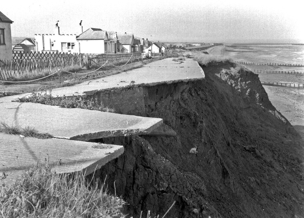
| Caption: | Stud Hill, E. of Coastguard Station between Swalecliffe and Herne Bay. |
| Description: | Stud Hill, E. of Coastguard Station between Swalecliffe and Herne Bay. Landslipping in London Clay cliffs. Rapid erosion has caused frequent slips, destroying recently constructed roads and dwellings sited near the present cliff edge. Earlier maps show that the cliff has receded markedly even in the last 50 years. Collapse after storms on September 20th, 1946. |
| Date taken: | Sun Sep 01 00:00:00 BST 1946 |
| Photographer: | Rhodes, J. |
| Copyright statement: | Crown |
| X longitude/easting: | 615500 |
| Y latitude/northing: | 167500 |
| Coordinate reference system, ESPG code: | 27700 (OSGB 1936 / British National Grid) |
| Orientation: | Landscape |
| Size: | 264.77 KB; 1000 x 717 pixels; 85 x 61 mm (print at 300 DPI); 265 x 190 mm (screen at 96 DPI); |
| Average Rating: | Not yet rated |
| Categories: | Unsorted Images, Geoscience subjects/ Landforms, weathering/ Landslips, Geoscience subjects/ Landforms, marine/ Coastal landslips |
Loading...
Loading...
Reviews
There is currently no feedback