| P number: | P207742 |
|---|---|
| Old photograph number: | A07820 |
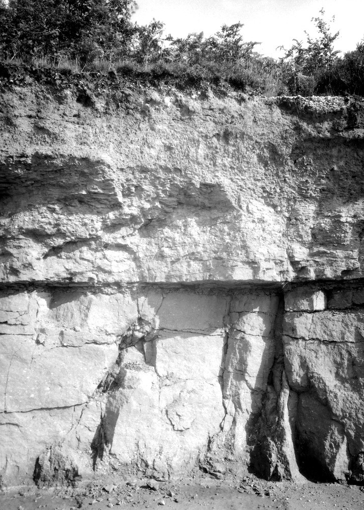
| Caption: | Jones's Gravel-pit, 1120 yd. NE of Trellech Church. Looking NE. |
| Description: | Jones's Gravel-pit, 1120 yd. NE of Trellech Church. Looking NE. Quartz Conglomerate section. Another view of gravel-pit face. [The quarry floor formed of red marl. Above is 4-6 feet of rather massive conglomerate. The upper beds consist of soft conglomeratic sandstone with marl layer at base: these rest unconformably on the lower deposit. Throughout the pit the cementing material in the conglomerate has broken down leaving a relatively soft pebbly sandstone which is used as a gravel.] |
| Date taken: | Thu Sep 01 00:00:00 BST 1938 |
| Photographer: | Rhodes, J. |
| Copyright statement: | Crown |
| X longitude/easting: | 350500 |
| Y latitude/northing: | 206500 |
| Coordinate reference system, ESPG code: | 27700 (OSGB 1936 / British National Grid) |
| Orientation: | Portrait |
| Size: | 321.63 KB; 715 x 1000 pixels; 61 x 85 mm (print at 300 DPI); 189 x 265 mm (screen at 96 DPI); |
| Average Rating: | Not yet rated |
| Categories: | Unsorted Images, Geoscience subjects/ Landforms, weathering/ Formation of soil and subsoil |
Loading...
Loading...
Reviews
There is currently no feedback