| P number: | P207718 |
|---|---|
| Old photograph number: | A07796 |
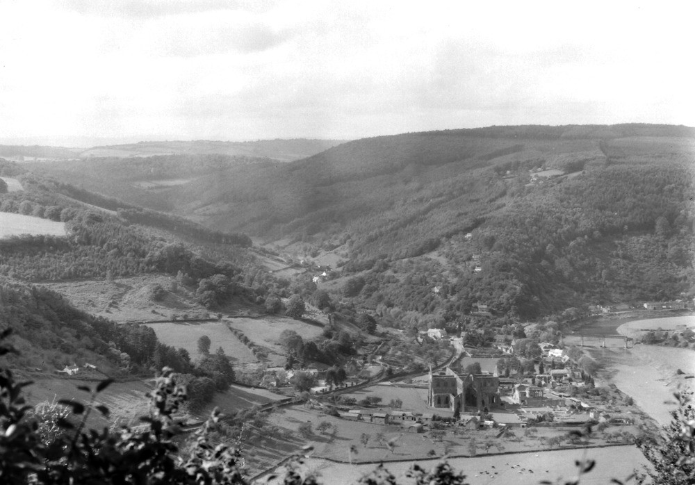
| Caption: | Viewpoint, Devil's Pulpit, 1500 yd. S. 37 degrees W. of Madgett. Looking NW. |
| Description: | Viewpoint, Devil's Pulpit, 1500 yd. S. 37 degrees W. of Madgett. Looking NW. View over Wye Valley at Tintern Abbey. The tree-covered hills on the right and centre (Barbadoes Hill) are formed of Old Red Sandstone (Tintern Sandstone). On the south side of the Angidy River, seen in centre, the bare fields above the tree line mark the lowest beds of the Carboniferous Limestone. In the distance is the Brownstone ridge running between Cobbler's Plain and Llanishen. |
| Date taken: | Thu Sep 01 00:00:00 BST 1938 |
| Photographer: | Rhodes, J. |
| Copyright statement: | Crown |
| X longitude/easting: | 364713 |
| Y latitude/northing: | 199326 |
| Coordinate reference system, ESPG code: | 27700 (OSGB 1936 / British National Grid) |
| Orientation: | Landscape |
| Size: | 174.83 KB; 1000 x 698 pixels; 85 x 59 mm (print at 300 DPI); 265 x 185 mm (screen at 96 DPI); |
| Average Rating: | Not yet rated |
| Categories: | Unsorted Images, Geoscience subjects/ General views/ Sand, sandstone and grit country |
Loading...
Loading...
Reviews
There is currently no feedback