| P number: | P207614 |
|---|---|
| Old photograph number: | A07690 |
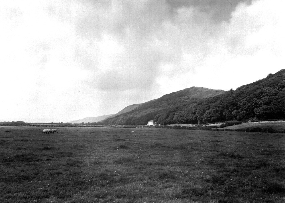
| Caption: | Holker, 1 m. NNW of Cark-in-Cartmel. Looking N. |
| Description: | Holker, 1 m. NNW of Cark-in-Cartmel. Looking N. Fault escarpment. Course of the Haverthwaite-Cark Fault. The low ground beneath the superficial deposits of marine alluvium, etc., is underlain by Carboniferous Limestone, which is thrown by the fault against Silurian rocks forming the high ground to the right. The escarpment also marks the position of an old sea cliff. |
| Date taken: | Fri Jul 01 00:00:00 BST 1938 |
| Photographer: | Rhodes, J. |
| Copyright statement: | Crown |
| X longitude/easting: | 335578 |
| Y latitude/northing: | 478008 |
| Coordinate reference system, ESPG code: | 27700 (OSGB 1936 / British National Grid) |
| Orientation: | Landscape |
| Size: | 199.08 KB; 1000 x 712 pixels; 85 x 60 mm (print at 300 DPI); 265 x 188 mm (screen at 96 DPI); |
| Average Rating: | Not yet rated |
| Categories: | Unsorted Images, Geoscience subjects/ Structural features/ Fault scarps |
Loading...
Loading...
Reviews
There is currently no feedback