| P number: | P207606 |
|---|---|
| Old photograph number: | A07682 |
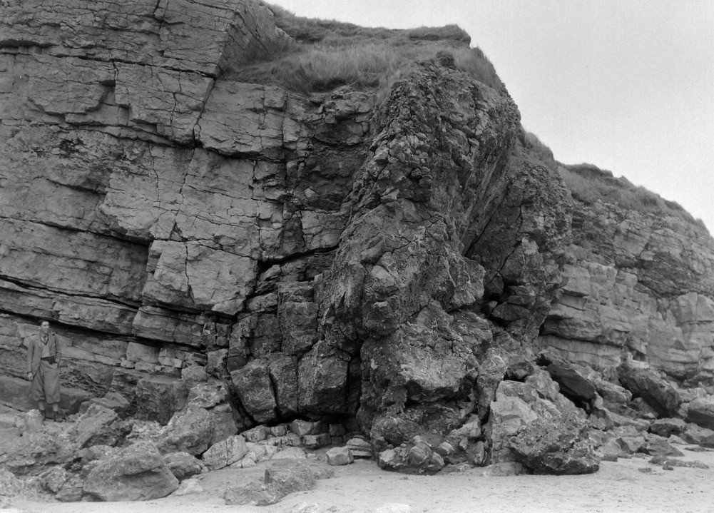
| Caption: | Dunnerholme Rock (NW end), about 1/2 m. W. of Marsh Grange. Looking SE. |
| Description: | Dunnerholme Rock (NW end), about 1/2 m. W. of Marsh Grange. Looking SE. Dolomitisation along fault zone. Carboniferous Limestone of the calcite-mudstone division faulted against the Red Hills Oolite division (right of picture). The shattered limestone is the fault zone, which is 18 feet wide, has been dolomitised and there are many irregular fissures occupied by coarse calcite. |
| Date taken: | Fri Jul 01 00:00:00 BST 1938 |
| Photographer: | Rhodes, J. |
| Copyright statement: | Crown |
| X longitude/easting: | 321016 |
| Y latitude/northing: | 479718 |
| Coordinate reference system, ESPG code: | 27700 (OSGB 1936 / British National Grid) |
| Orientation: | Landscape |
| Size: | 261.69 KB; 1001 x 719 pixels; 85 x 61 mm (print at 300 DPI); 265 x 190 mm (screen at 96 DPI); |
| Average Rating: | Not yet rated |
| Categories: | Unsorted Images, Geoscience subjects/ Structural features/ Faulting |
Loading...
Loading...
Reviews
There is currently no feedback