| P number: | P207192 |
|---|---|
| Old photograph number: | A07267 |
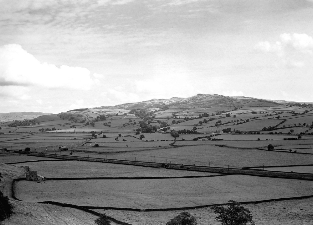
| Caption: | Millstone Grit country, near Carleton Biggin, Skipton, Yorkshire. |
| Description: | Looking north-east from the viewpoint, near Carleton Biggin, about 2 miles south of Skipton. Low ground in left distance marks the position of Skipton Anticline bounded in distance by Millstone Grits forming northern flanks of this anticline. The photograph is taken approximately along the strike and the hills in the centre are composed of the southerly dipping grits forming the southern limb of the anticline. Note lower enclosed slopes covered by glacial drift with grit edges standing out above. In middle of the picture is the alluvial flat of River Aire with boulder clay rising out of it in the foreground. The Millstone Grit is a series of Upper Carboniferous river deposited sandstones, coarse grits and shale up to 2000 metres thick. They were mostly deposited in flood plains and deltas flowing down from the Scottish Highlands. The Millstone Grit rests unconformably on the earlier Carboniferous rocks. |
| Date taken: | Sun Aug 01 00:00:00 BST 1937 |
| Photographer: | Rhodes, J. |
| Copyright statement: | Crown |
| X longitude/easting: | 398541 |
| Y latitude/northing: | 448756 |
| Coordinate reference system, ESPG code: | 27700 (OSGB 1936 / British National Grid) |
| Orientation: | Landscape |
| Size: | 191.52 KB; 1000 x 717 pixels; 85 x 61 mm (print at 300 DPI); 265 x 190 mm (screen at 96 DPI); |
| Average Rating: | Not yet rated |
| Categories: | Unsorted Images, Geoscience subjects/ General views/ Sand, sandstone and grit country |
Loading...
Loading...
Reviews
There is currently no feedback