| P number: | P207174 |
|---|---|
| Old photograph number: | A07249 |
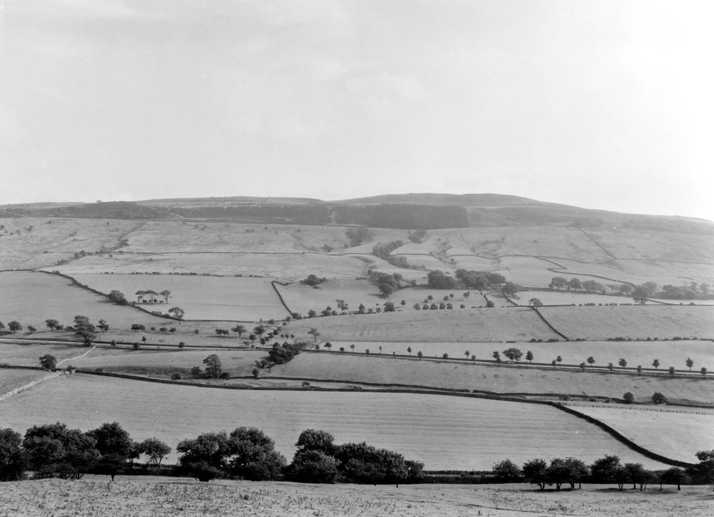
| Caption: | Viewpoint, Haw Bank, 1 1/2 m. NE of Skipton. Looking S. |
| Description: | Viewpoint, Haw Bank, 1 1/2 m. NE of Skipton. Looking S. Looking across the southern limb of the Skipton Anticline down dip from the central ridge running along the axis of the fold. Foreground: Haw Bank Limestone extending to road at foot of field with thistles. Slack running parallel to road is occupied by Halton Shales. Ridge beyond consists of Embsay Limestone while the beck beyond flows over Skibeden Shales which rise up to the line of old quarries beside the farm of Close House. These quarries mark the position of the Draughton Limestone. Slopes above trenched by streams composed of Bowland Shales. Wooded escarpments behind consist of Millstone Grit. Note rounded drumlin in front of and to right of Close House. |
| Date taken: | Sun Aug 01 00:00:00 BST 1937 |
| Photographer: | Rhodes, J. |
| Copyright statement: | Crown |
| X longitude/easting: | 400911 |
| Y latitude/northing: | 452619 |
| Coordinate reference system, ESPG code: | 27700 (OSGB 1936 / British National Grid) |
| Orientation: | Landscape |
| Size: | 159.27 KB; 1001 x 725 pixels; 85 x 61 mm (print at 300 DPI); 265 x 192 mm (screen at 96 DPI); |
| Average Rating: | Not yet rated |
| Categories: | Unsorted Images |
Loading...
Loading...
Reviews
There is currently no feedback