| P number: | P207025 |
|---|---|
| Old photograph number: | A07100 |
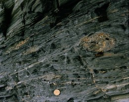
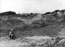
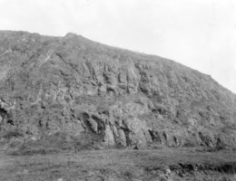
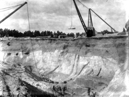
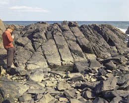
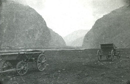
| Caption: | Gravel working, Dunton Green, Kent. |
| Description: | West of the main London road, Dunton Green. Looking north-north-west. Gravel working in River Darent alluvium. General view of the pit. Gravel for concrete making is an important resource in the London Basin. Gravel 8 or 10 feet thick is worked beneath the water. It rests on Folkestone Beds, the sand of which is also excavated. The bank of the stream, seen on right of the picture is on Gault. The hills in the background are the Chalk escarpment, Pol Hill being on the right above the chalk-pit. The London Basin has been subjected to a number of changes of level since the Pliocene times. One result has been the formation of a complex series of gravels and loams forming terraces in the valley of the Thames and its tributaries. |
| Date taken: | Sat May 01 00:00:00 BST 1937 |
| Photographer: | Rhodes, J. |
| Copyright statement: | Crown |
| X longitude/easting: | 550500 |
| Y latitude/northing: | 157500 |
| Coordinate reference system, ESPG code: | 27700 (OSGB 1936 / British National Grid) |
| Orientation: | Landscape |
| Size: | 199.94 KB; 1001 x 703 pixels; 85 x 60 mm (print at 300 DPI); 265 x 186 mm (screen at 96 DPI); |
| Average Rating: | Not yet rated |
| Categories: | Unsorted Images, Geoscience subjects/ Economic geology/ Gravel and sand |
Loading...
Loading...
Reviews
There is currently no feedback