| P number: | P207017 |
|---|---|
| Old photograph number: | A07092 |
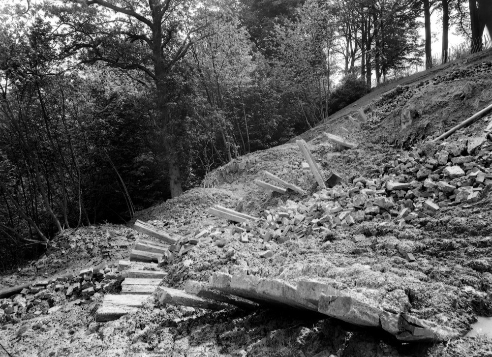
| Caption: | Bidborough Ridge, 350 yd. W. Bidborough Corner, (3/4 m. ENE Bidborough). Looking E. |
| Description: | Bidborough Ridge, 350 yd. W. Bidborough Corner, (3/4 m. ENE Bidborough). Looking E. Landslip at junction of Lower Tunbridge Wells Sand and Wadhurst Clay. A road, the edge of which is indicated by the fence shown near the top right-hand corner of the view, is built on Lower Tunbridge Wells Sand. Immediately below the fence the strata consists of Wadhurst Clay in which the slipping has taken place. The photograph shows the result of the movement after an interval of a year from the position shown in A6814. |
| Date taken: | Sat May 01 00:00:00 BST 1937 |
| Photographer: | Rhodes, J. |
| Copyright statement: | Crown |
| X longitude/easting: | 557500 |
| Y latitude/northing: | 143500 |
| Coordinate reference system, ESPG code: | 27700 (OSGB 1936 / British National Grid) |
| Orientation: | Landscape |
| Size: | 359.46 KB; 1000 x 726 pixels; 85 x 61 mm (print at 300 DPI); 265 x 192 mm (screen at 96 DPI); |
| Average Rating: | Not yet rated |
| Categories: | Unsorted Images, Geoscience subjects/ Landforms, weathering/ Landslips |
Loading...
Loading...
Reviews
There is currently no feedback