| P number: | P207015 |
|---|---|
| Old photograph number: | A07090 |
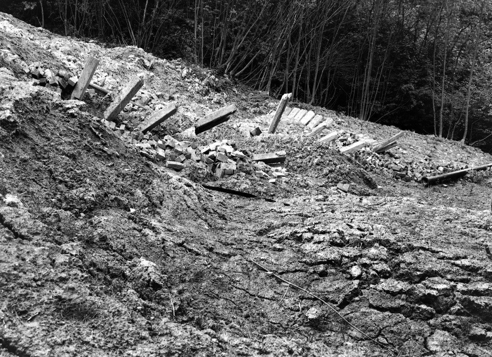
| Caption: | Bidborough Ridge, 350 yd. W. Bidborough Corner, (3/4 m. ENE Bidborough). Looking W. |
| Description: | Bidborough Ridge, 350 yd. W. Bidborough Corner, (3/4 m. ENE Bidborough). Looking W. Landslip at junction of Lower Tunbridge Wells Sand and Wadhurst Clay. The posts were originally driven vertically, side by side, along a straight line in the Wadhurst Clay. Slipping carried them downhill as shown in a previous photograph (A6814) taken in June, 1936. Subsequent movement has forced many of the posts out of the clay and thrown some of them into a horizontal position. |
| Date taken: | Sat May 01 00:00:00 BST 1937 |
| Photographer: | Rhodes, J. |
| Copyright statement: | Crown |
| X longitude/easting: | 557500 |
| Y latitude/northing: | 143500 |
| Coordinate reference system, ESPG code: | 27700 (OSGB 1936 / British National Grid) |
| Orientation: | Landscape |
| Size: | 410.56 KB; 1000 x 726 pixels; 85 x 61 mm (print at 300 DPI); 265 x 192 mm (screen at 96 DPI); |
| Average Rating: | Not yet rated |
| Categories: | Unsorted Images, Geoscience subjects/ Landforms, weathering/ Landslips |
Loading...
Loading...
Reviews
There is currently no feedback