| P number: | P206863 |
|---|---|
| Old photograph number: | A06934 |
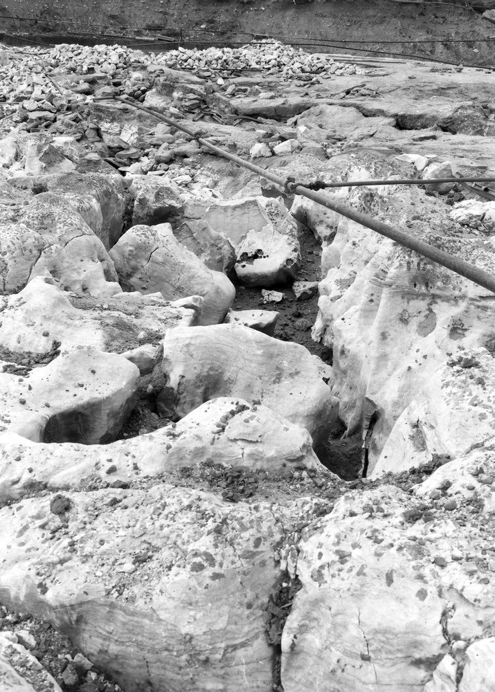
| Caption: | McGhie's Quarry, Kirkby Thore, 1 1/4 m. NNE of Kirkby Thore Station. Looking W. |
| Description: | McGhie's Quarry, Kirkby Thore, 1 1/4 m. NNE of Kirkby Thore Station. Looking W. Deeply channelled surface of Gypsum Bed. The type of channelling strikingly resembles a griked surface of limestone due to subaerial erosion. |
| Date taken: | Thu Oct 01 00:00:00 BST 1936 |
| Photographer: | Rhodes, J. |
| Copyright statement: | Crown |
| X longitude/easting: | 364324 |
| Y latitude/northing: | 526930 |
| Coordinate reference system, ESPG code: | 27700 (OSGB 1936 / British National Grid) |
| Orientation: | Portrait |
| Size: | 314.87 KB; 715 x 1000 pixels; 61 x 85 mm (print at 300 DPI); 189 x 265 mm (screen at 96 DPI); |
| Average Rating: | Not yet rated |
| Categories: | Unsorted Images, Geoscience subjects/ Economic geology/ Gypsum, Geoscience subjects/ Landforms, weathering/ Solution effects |
Loading...
Loading...
Reviews
There is currently no feedback