| P number: | P206818 |
|---|---|
| Old photograph number: | A06889 |
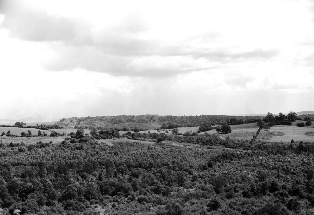
| Caption: | Viewpoint, 3/8 m. NNE of Witnell's End, 3/4 m. NE of Shatterford. Looking E. |
| Description: | Viewpoint, 3/8 m. NNE of Witnell's End, 3/4 m. NE of Shatterford. Looking E. View looking east from Trimpley Anticline. Coal Measures and Downtonian of Trimpley Anticline under wooded valley in foreground. Middle distance, right, Castle Hill, feature of Clent Breccia. Distance, Kinver Edge, escarpment on Bunter Pebble Beds on Lower Bunter. Far distance, left, South Staffordshire Coalfield with Wren's Nest and Castle Hills. |
| Date taken: | Mon Jun 01 00:00:00 BST 1936 |
| Photographer: | Rhodes, J. |
| Copyright statement: | Crown |
| X longitude/easting: | 379500 |
| Y latitude/northing: | 281500 |
| Coordinate reference system, ESPG code: | 27700 (OSGB 1936 / British National Grid) |
| Orientation: | Landscape |
| Size: | 183.00 KB; 1000 x 684 pixels; 85 x 58 mm (print at 300 DPI); 265 x 181 mm (screen at 96 DPI); |
| Average Rating: | Not yet rated |
| Categories: | Unsorted Images |
Loading...
Loading...
Reviews
There is currently no feedback