| P number: | P206751 |
|---|---|
| Old photograph number: | A06822 |
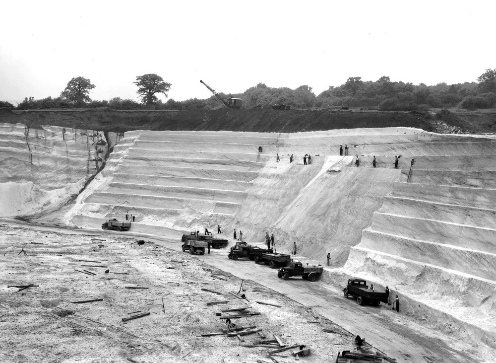
| Caption: | 300 yd. N. Covers Farm, the Squerryes Estate Sand-pit, Westerham. Looking NW. |
| Description: | 300 yd. N. Covers Farm, the Squerryes Estate Sand-pit, Westerham. Looking NW. Extensive working of Folkestone Beds. The Folkestone Sand is markedly current-bedded. The dark overburden is Gault Clay. The photograph shows well the method of working this type of deposit. |
| Date taken: | Mon Jun 01 00:00:00 BST 1936 |
| Photographer: | Rhodes, J. |
| Copyright statement: | Crown |
| X longitude/easting: | 543500 |
| Y latitude/northing: | 153500 |
| Coordinate reference system, ESPG code: | 27700 (OSGB 1936 / British National Grid) |
| Orientation: | Landscape |
| Size: | 248.05 KB; 1000 x 731 pixels; 85 x 62 mm (print at 300 DPI); 265 x 193 mm (screen at 96 DPI); |
| Average Rating: | Not yet rated |
| Categories: | Unsorted Images, Geoscience subjects/ Economic geology/ Gravel and sand |
Loading...
Loading...
Reviews
There is currently no feedback