| P number: | P206741 |
|---|---|
| Old photograph number: | A06812 |
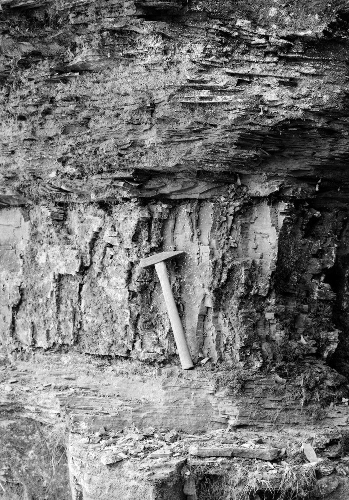
| Caption: | 1,100 yd. SW St. Mary's Church, Speldhurst. Looking SW. |
| Description: | 1,100 yd. SW St. Mary's Church, Speldhurst. Looking SW. Highest beds of Lower Tunbridge Wells Sand. The photograph shows these thin, flaggy and current-bedded sandstones which are developed between the highest massive sandrock of the Lower Tunbridge Wells Sand and the base of the Grinstead Clay. Associated with the sandstones are ? inch beds of clay - the hammer shaft rests on one. Another may be seen one-third of a hammer length above the head. |
| Date taken: | Mon Jun 01 00:00:00 BST 1936 |
| Photographer: | Rhodes, J. |
| Copyright statement: | Crown |
| X longitude/easting: | 554500 |
| Y latitude/northing: | 140500 |
| Coordinate reference system, ESPG code: | 27700 (OSGB 1936 / British National Grid) |
| Orientation: | Portrait |
| Size: | 384.17 KB; 697 x 1000 pixels; 59 x 85 mm (print at 300 DPI); 184 x 265 mm (screen at 96 DPI); |
| Average Rating: | Not yet rated |
| Categories: | Unsorted Images, Geoscience subjects/ Structural features/ Stratification |
Loading...
Loading...
Reviews
There is currently no feedback