| P number: | P206622 |
|---|---|
| Old photograph number: | A06693 |
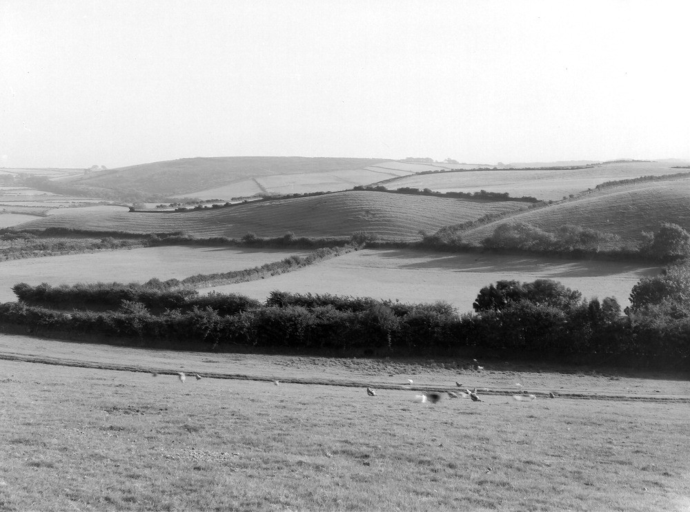
| Caption: | From 200 yd. NE of Beck Cote, 1 1/4 m. NNE of Calder Bridge. Looking S. |
| Description: | From 200 yd. NE of Beck Cote, 1 1/4 m. NNE of Calder Bridge. Looking S. Eastern end of Abbey Flats delta. Shoulder in middle distance (centre) is gravel delta with flat top at 485 ft. O.D. (with a lower level 450 ft. O.D. delta to the left) immediately behind is the 500 ft. level of the Abbey Flats delta with bare St. Bees Sandstone (Scar Green) in the distance. Trees in the foreground obscure the Beck Cote Channel. |
| Date taken: | Thu Aug 01 00:00:00 BST 1935 |
| Photographer: | Rhodes, J. |
| Copyright statement: | Crown |
| X longitude/easting: | 305733 |
| Y latitude/northing: | 507520 |
| Coordinate reference system, ESPG code: | 27700 (OSGB 1936 / British National Grid) |
| Orientation: | Landscape |
| Size: | 206.75 KB; 1000 x 743 pixels; 85 x 63 mm (print at 300 DPI); 265 x 197 mm (screen at 96 DPI); |
| Average Rating: | Not yet rated |
| Categories: | Unsorted Images, Geoscience subjects/ Landforms, glaciation/ Deltas and outwash fans |
Loading...
Loading...
Reviews
There is currently no feedback