| P number: | P206394 |
|---|---|
| Old photograph number: | A06465 |
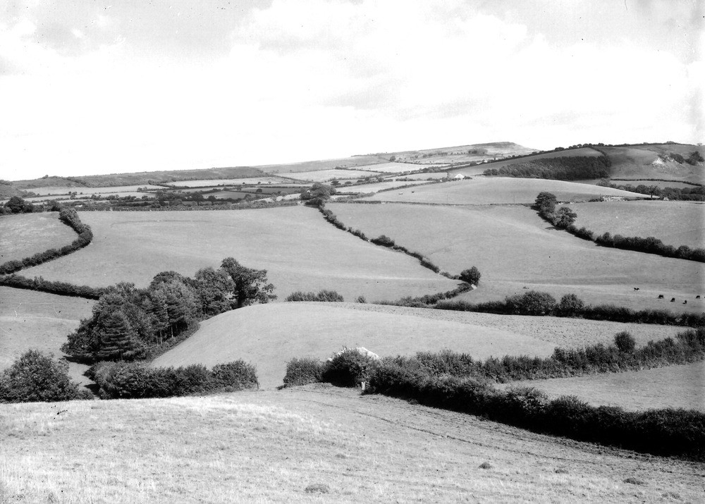
| Caption: | In field, about 1/2 m. S. of Birdsmoor Gate. Looking NNE. |
| Description: | In field, about 1/2 m. S. of Birdsmoor Gate. Looking NNE. Landslip topography, Birdsmoor Gate. In foreground is a slipped mass of sandy Middle Lias. On left is characteristic 'back-slope' of a slipped mass. In middle distance is a ridge of Middle Lias terminating (on right) in Sliding Hill. In background is seen the Greensand hill of Pilsdon Pen. |
| Date taken: | Wed Aug 01 00:00:00 BST 1934 |
| Photographer: | Rhodes, J. |
| Copyright statement: | Crown |
| X longitude/easting: | 339500 |
| Y latitude/northing: | 100500 |
| Coordinate reference system, ESPG code: | 27700 (OSGB 1936 / British National Grid) |
| Orientation: | Landscape |
| Size: | 204.61 KB; 1000 x 715 pixels; 85 x 61 mm (print at 300 DPI); 265 x 189 mm (screen at 96 DPI); |
| Average Rating: | Not yet rated |
| Categories: | Unsorted Images, Geoscience subjects/ Landforms, weathering/ Landslips |
Loading...
Loading...
Reviews
There is currently no feedback