| P number: | P206385 |
|---|---|
| Old photograph number: | A06456 |
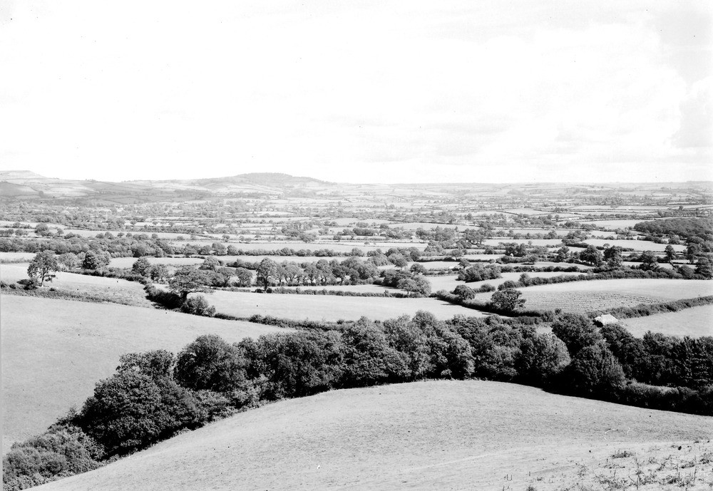
| Caption: | Viewpoint, E. side of Conegar Hill, Wootton Fitzpaine. Looking NE. |
| Description: | Viewpoint, E. side of Conegar Hill, Wootton Fitzpaine. Looking NE. Lower Lias topography, Marshwood Vale. The nearly level basin known as Marshwood Vale has been excavated in Lower Lias clays. Bordering the Vale the sandy beds of the Middle Lias form the low encircling ridge, whilst to the left the high points of Pilsdon Pen (909 ft. O.D.) and the wooded Lewesdon (900 ft. O.D.) are formed of Upper Greensand and Gault cappings. |
| Date taken: | Wed Aug 01 00:00:00 BST 1934 |
| Photographer: | Rhodes, J. |
| Copyright statement: | Crown |
| X longitude/easting: | 338500 |
| Y latitude/northing: | 95500 |
| Coordinate reference system, ESPG code: | 27700 (OSGB 1936 / British National Grid) |
| Orientation: | Landscape |
| Size: | 212.44 KB; 1000 x 689 pixels; 85 x 58 mm (print at 300 DPI); 265 x 182 mm (screen at 96 DPI); |
| Average Rating: | Not yet rated |
| Categories: | Unsorted Images, Geoscience subjects/ General views/ Clay, marl and shale country |
Loading...
Loading...
Reviews
There is currently no feedback