| P number: | P206286 |
|---|---|
| Old photograph number: | A06357 |
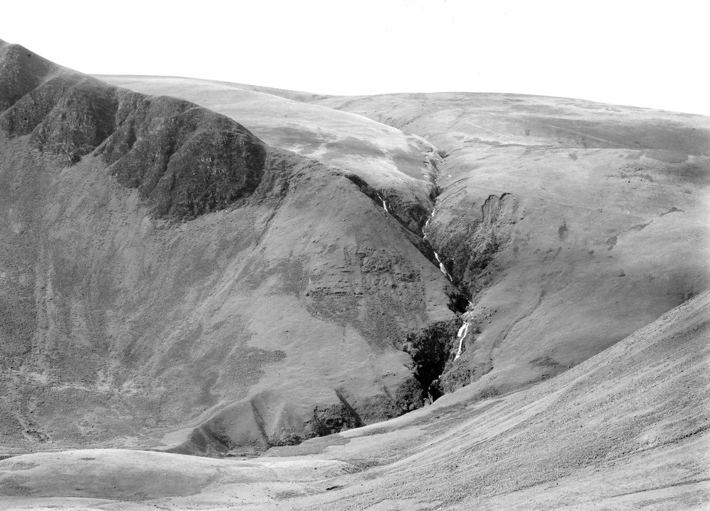
| Caption: | Cautley Spout, 4 m. NE of Sedbergh. Looking W. |
| Description: | Cautley Spout, 4 m. NE of Sedbergh. Looking W. Hanging valley and river diversion. The valley of Red Gill Beck has been diverted by glacial erosion at the head of the cwm. The original course of Red Gill Beck occupied the 'wick' seen high on the hill on the right of the photograph, whence it flowed down Bowderdale. |
| Date taken: | Sun Oct 01 00:00:00 BST 1933 |
| Photographer: | Rhodes, J. |
| Copyright statement: | Crown |
| X longitude/easting: | 368500 |
| Y latitude/northing: | 497500 |
| Coordinate reference system, ESPG code: | 27700 (OSGB 1936 / British National Grid) |
| Orientation: | Landscape |
| Size: | 229.83 KB; 1001 x 721 pixels; 85 x 61 mm (print at 300 DPI); 265 x 191 mm (screen at 96 DPI); |
| Average Rating: | Not yet rated |
| Categories: | Unsorted Images, Geoscience subjects/ Landforms, glaciation/ Glacial deposits, boulder clay, sand, gravel, Geoscience subjects/ Landforms, river/ River capture and diverted drainage, Geoscience subjects/ Landforms, glaciation/ Ice-moulded slopes, Geoscience subjects/ Landforms, glaciation/ Hanging valleys and gorges |
Loading...
Loading...
Reviews
There is currently no feedback