| P number: | P206284 |
|---|---|
| Old photograph number: | A06355 |
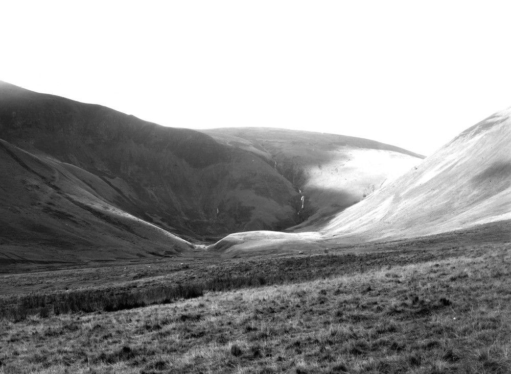
| Caption: | Cautley Spout, 4 m. NE of Sedbergh. Looking W. |
| Description: | Cautley Spout, 4 m. NE of Sedbergh. Looking W. River diversion at Cautley Spout. The valley of Bowderdale reaches its present head in the gap on the right of the photograph. Its original head was, however, in Cautley Crags on the extreme left of the photograph. This stream was captured by Cautley Beck (in foreground) in Pre-glacial or early Glacial times, and the Bowderdale Beck beheaded. Later glacial erosion in the cwm has eroded back the head to such an extent that Red Gill Beck has been captured and falls to the main valley in a hanging valley. Note breached moraine of cwm glacier at foot of cwm. |
| Date taken: | Sun Oct 01 00:00:00 BST 1933 |
| Photographer: | Rhodes, J. |
| Copyright statement: | Crown |
| X longitude/easting: | 368500 |
| Y latitude/northing: | 497500 |
| Coordinate reference system, ESPG code: | 27700 (OSGB 1936 / British National Grid) |
| Orientation: | Landscape |
| Size: | 179.56 KB; 1000 x 733 pixels; 85 x 62 mm (print at 300 DPI); 265 x 194 mm (screen at 96 DPI); |
| Average Rating: | Not yet rated |
| Categories: | Unsorted Images, Geoscience subjects/ Landforms, river/ River capture and diverted drainage |
Loading...
Loading...
Reviews
There is currently no feedback