| P number: | P206264 |
|---|---|
| Old photograph number: | A06335 |
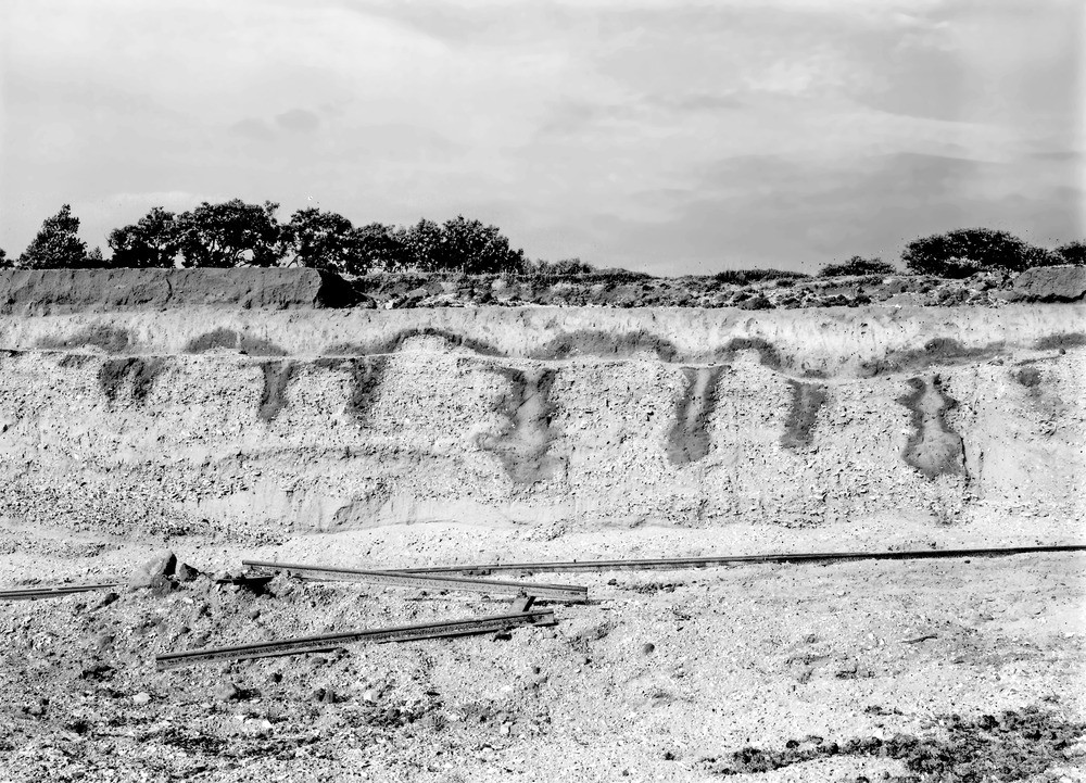
| Caption: | Gravel-pit, just W. of Rauceby Station, 2 1/4 m. SW of Sleaford. Looking NE. |
| Description: | Gravel-pit, just W. of Rauceby Station, 2 1/4 m. SW of Sleaford. Looking NE. Piping and festooning in stratified river gravels, Rauceby (see A6334). [Stratified gravels in the Honington Gap at Rauceby. The Honington Gap was formerly the course of the River Witham. The current-bedding of the gravels is clearly seen. The surface of the gravel beneath a deposit of sand and loam is piped and festooned.] |
| Date taken: | Fri Sep 01 00:00:00 BST 1933 |
| Photographer: | Rhodes, J. |
| Copyright statement: | Crown |
| X longitude/easting: | 503500 |
| Y latitude/northing: | 344500 |
| Coordinate reference system, ESPG code: | 27700 (OSGB 1936 / British National Grid) |
| Orientation: | Landscape |
| Size: | 315.53 KB; 1000 x 721 pixels; 85 x 61 mm (print at 300 DPI); 265 x 191 mm (screen at 96 DPI); |
| Average Rating: | Not yet rated |
| Categories: | Unsorted Images, Geoscience subjects/ Landforms, karst/ Solution pipes |
Loading...
Loading...
Reviews
There is currently no feedback