| P number: | P205967 |
|---|---|
| Old photograph number: | A06038 |
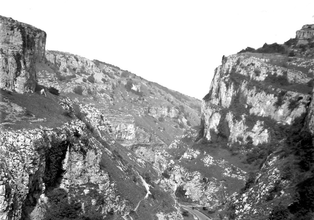
| Caption: | Cheddar, Cheddar Gorge. Looking N. |
| Description: | Cheddar, Cheddar Gorge. Looking N. The vertical east wall of the gorge (right side) is a scarp slope, due to strong vertical jointing of the Carboniferous Limestone (Seminula Zone, and Dibunophyllum Zone in extreme top right-hand crag). The more gently sloping west wall is a dip-slope, locally steepened by breaking away of limestone along vertical jonts. |
| Date taken: | Thu Sep 01 00:00:00 BST 1932 |
| Photographer: | Rhodes, J. |
| Copyright statement: | Crown |
| X longitude/easting: | 337500 |
| Y latitude/northing: | 154500 |
| Coordinate reference system, ESPG code: | 27700 (OSGB 1936 / British National Grid) |
| Orientation: | Landscape |
| Size: | 249.98 KB; 1000 x 701 pixels; 85 x 59 mm (print at 300 DPI); 265 x 185 mm (screen at 96 DPI); |
| Average Rating: | Not yet rated |
| Categories: | Unsorted Images, Geoscience subjects/ Landforms, river/ Gorges and ravines |
Loading...
Loading...
Reviews
There is currently no feedback