| P number: | P205854 |
|---|---|
| Old photograph number: | A05924 |
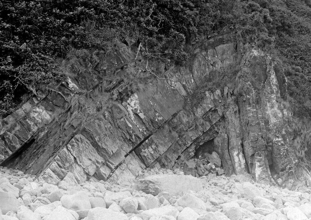
| Caption: | About 1/2 m. NW of Clovelly Harbour. Looking W. |
| Description: | About 1/2 m. NW of Clovelly Harbour. Looking W. Anticline in Culm sandstones and shales near Clovelly Harbour. In the base of the fold the sandstones have been folded into a V, higher up they have arched over in a sigmoid flexure. |
| Date taken: | Mon Aug 01 00:00:00 BST 1932 |
| Photographer: | Rhodes, J. |
| Copyright statement: | Crown |
| X longitude/easting: | 231500 |
| Y latitude/northing: | 125500 |
| Coordinate reference system, ESPG code: | 27700 (OSGB 1936 / British National Grid) |
| Orientation: | Landscape |
| Size: | 329.98 KB; 1000 x 708 pixels; 85 x 60 mm (print at 300 DPI); 265 x 187 mm (screen at 96 DPI); |
| Average Rating: | Not yet rated |
| Categories: | Unsorted Images, Geoscience subjects/ Structural features/ Folding |
Loading...
Loading...
Reviews
There is currently no feedback