| P number: | P205786 |
|---|---|
| Old photograph number: | A05856 |
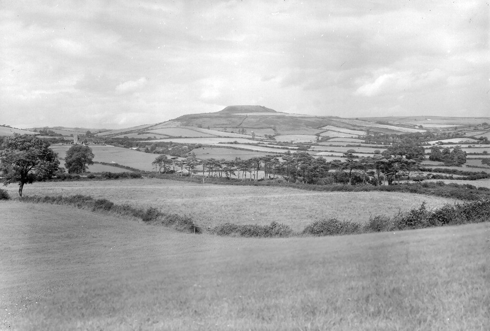
| Caption: | Viewpoint, about 1/2 m. S. of Shipton Gorge. Looking NE. |
| Description: | Viewpoint, about 1/2 m. S. of Shipton Gorge. Looking NE. Shipton Hill, and scenery near Shipton Gorge. Viewed from Cornbrash ridge south of Shipton Gorge village. Dip-slope of Cornbrash in foreground passing under Oxford Clay which is faulted off just south of Shipton Church (on left). The church stands on Inferior Oolite which terminates against the fault to the right. The distant flat topped hill (Shipton Hill) is an outlier of Greensand, the upper part sharpened to form an ancient camp rampart. The lower slopes are Fuller's Earth Clay. |
| Date taken: | Fri Jul 01 00:00:00 BST 1932 |
| Photographer: | Rhodes, J. |
| Copyright statement: | Crown |
| X longitude/easting: | 349500 |
| Y latitude/northing: | 90500 |
| Coordinate reference system, ESPG code: | 27700 (OSGB 1936 / British National Grid) |
| Orientation: | Landscape |
| Size: | 176.11 KB; 1000 x 676 pixels; 85 x 57 mm (print at 300 DPI); 265 x 179 mm (screen at 96 DPI); |
| Average Rating: | Not yet rated |
| Categories: | Unsorted Images, Geoscience subjects/ General views/ Clay, marl and shale country |
Loading...
Loading...
Reviews
There is currently no feedback