| P number: | P205712 |
|---|---|
| Old photograph number: | A05779 |
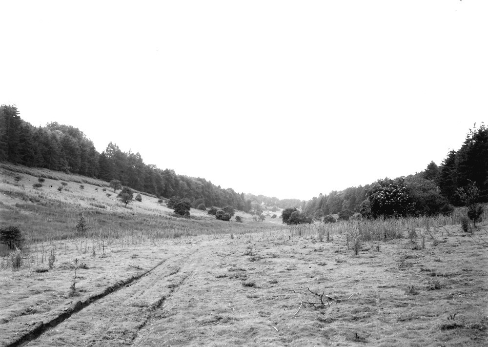
| Caption: | Six Wells Bottom, Stourton. Looking NW. |
| Description: | Six Wells Bottom, Stourton. Looking NW. Dry valley in Upper Greensand, Stourton. A stream flowed through this valley, probably in Roman times. The well head has great legendary repute, and the legends, coupled with evidence from the Cranborne Chase district, indicate that the water-table was formerly at a higher level than it is now. See 'Excavations in Cranborne Chase', privately printed, 1887, and 'Water supply of Wiltshire' (Mem. Geol. Surv.), 1925, pp.14, 15. |
| Date taken: | Fri Jul 01 00:00:00 BST 1932 |
| Photographer: | Rhodes, J. |
| Copyright statement: | Crown |
| X longitude/easting: | 376500 |
| Y latitude/northing: | 134500 |
| Coordinate reference system, ESPG code: | 27700 (OSGB 1936 / British National Grid) |
| Orientation: | Landscape |
| Size: | 168.19 KB; 1000 x 711 pixels; 85 x 60 mm (print at 300 DPI); 265 x 188 mm (screen at 96 DPI); |
| Average Rating: | Not yet rated |
| Categories: | Unsorted Images, Geoscience subjects/ General views/ Sand, sandstone and grit country |
Loading...
Loading...
Reviews
There is currently no feedback