| P number: | P205501 |
|---|---|
| Old photograph number: | A05567 |
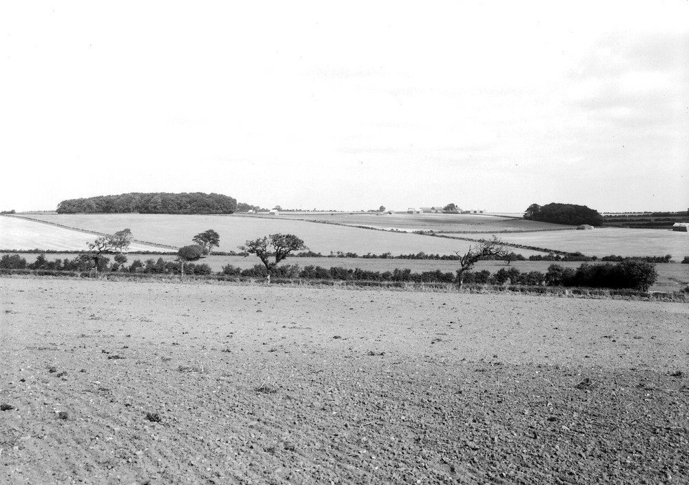
| Caption: | Viewpoint, 1 m. SE of Warham All Saints. Looking NE. |
| Description: | Viewpoint, 1 m. SE of Warham All Saints. Looking NE. Chalk downland scenery (Battlelore Hill). The Chalk uplands when un-covered by superficial deposits present the characteristic scenery of Downs - gently curved surfaces with sparse vegetation. The soft features of the land-relief are the result of long-continued subaerial denudation acting on a homogeneous formation. |
| Date taken: | Thu Oct 01 00:00:00 BST 1931 |
| Photographer: | Rhodes, J. |
| Copyright statement: | Crown |
| X longitude/easting: | 595500 |
| Y latitude/northing: | 340500 |
| Coordinate reference system, ESPG code: | 27700 (OSGB 1936 / British National Grid) |
| Orientation: | Landscape |
| Size: | 214.74 KB; 1000 x 704 pixels; 85 x 60 mm (print at 300 DPI); 265 x 186 mm (screen at 96 DPI); |
| Average Rating: | Not yet rated |
| Categories: | Unsorted Images, Geoscience subjects/ General views/ Chalk country |
Loading...
Loading...
Reviews
There is currently no feedback