| P number: | P205460 |
|---|---|
| Old photograph number: | A05526 |
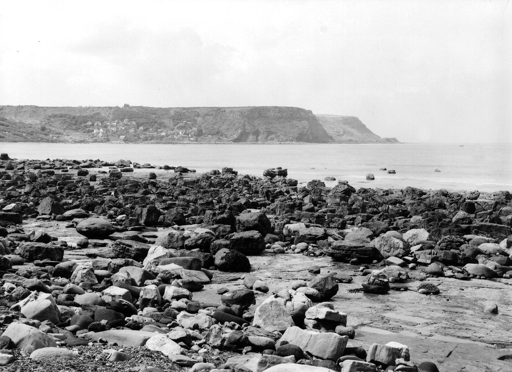
| Caption: | Runswick Bay. Looking NW. |
| Description: | Runswick Bay. Looking NW. Runswick Bay and Jurassic headlands. The nearer headland is Caldron Cliff, the further High Lingrow. A north and south fault throwing down 50 ft. west (away from camera) cuts off the former; it runs through the village, which is built on landslip terraces, due to the fault. The cliffs are mostly Upper Lias. The overlying Dogger shows clearly near the top of Caldron Cliff. At High Lingrow it is overlain by Estuarine Beds. To the left of the village is a drift-filled pre-glacial valley. |
| Date taken: | Wed Jul 01 00:00:00 BST 1931 |
| Photographer: | Rhodes, J. |
| Copyright statement: | Crown |
| X longitude/easting: | 481500 |
| Y latitude/northing: | 516500 |
| Coordinate reference system, ESPG code: | 27700 (OSGB 1936 / British National Grid) |
| Orientation: | Landscape |
| Size: | 254.25 KB; 1000 x 728 pixels; 85 x 62 mm (print at 300 DPI); 265 x 193 mm (screen at 96 DPI); |
| Average Rating: | Not yet rated |
| Categories: | Unsorted Images |
Loading...
Loading...
Reviews
There is currently no feedback