| P number: | P205457 |
|---|---|
| Old photograph number: | A05523 |
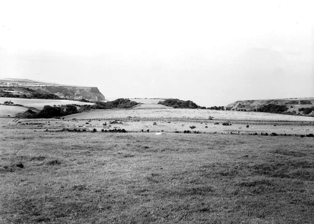
| Caption: | Westfield Farm, S. of Runswick Bay. Looking N. |
| Description: | Westfield Farm, S. of Runswick Bay. Looking N. Two parallel streams, replacing one pre-glacial stream, Westfield Farm, Runswick Bay. (See A5522). Extending from the camera to the coast in the centre of the picture is a plug of boulder clay, the level top of which is called Randy Bell, filling a pre-glacial valley. The wooded valleys, roughly parallel on either side, have been cut by the present streams along the margins of the plug of hard clay and reach the sea by separate mouths. |
| Date taken: | Wed Jul 01 00:00:00 BST 1931 |
| Photographer: | Rhodes, J. |
| Copyright statement: | Crown |
| X longitude/easting: | 482500 |
| Y latitude/northing: | 515500 |
| Coordinate reference system, ESPG code: | 27700 (OSGB 1936 / British National Grid) |
| Orientation: | Landscape |
| Size: | 227.29 KB; 1001 x 715 pixels; 85 x 61 mm (print at 300 DPI); 265 x 189 mm (screen at 96 DPI); |
| Average Rating: | Not yet rated |
| Categories: | Unsorted Images |
Loading...
Loading...
Reviews
There is currently no feedback