| P number: | P205286 |
|---|---|
| Old photograph number: | A05352 |
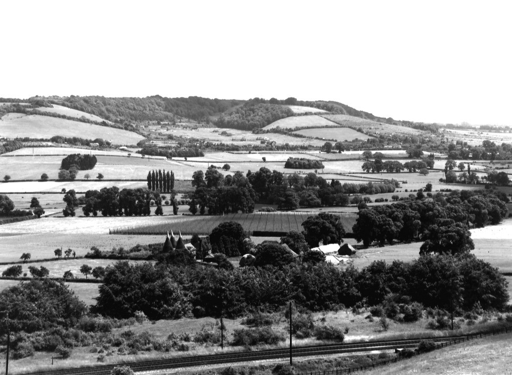
| Caption: | Viewpoint, slopes of Polhill. Looking E. |
| Description: | Viewpoint, slopes of Polhill. Looking E. The Darent Gap in the North Downs. A view acrosss the Darent Gap. The escarpment of the North Downs at Otford Mount forms the skyline. The slopes of Middle and Lower Chalk and Gault occupy the low ground to the right. The alluvium of the Darent crosses the view below the line of poplars. The village of Otford is on the right of the picture, and typical Kentish hop-field and oast houses are seen in the foreground. |
| Date taken: | Mon Jun 01 00:00:00 BST 1931 |
| Photographer: | Rhodes, J. |
| Copyright statement: | Crown |
| X longitude/easting: | 550500 |
| Y latitude/northing: | 160500 |
| Coordinate reference system, ESPG code: | 27700 (OSGB 1936 / British National Grid) |
| Orientation: | Landscape |
| Size: | 207.90 KB; 1000 x 733 pixels; 85 x 62 mm (print at 300 DPI); 265 x 194 mm (screen at 96 DPI); |
| Average Rating: | Not yet rated |
| Categories: | Unsorted Images, Geoscience subjects/ General views/ Chalk country |
Loading...
Loading...
Reviews
There is currently no feedback