| P number: | P006539 |
|---|---|
| Old photograph number: | A11284 |
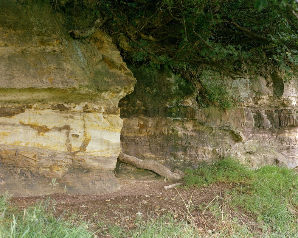
| Caption: | Pett, 920 metres N. 44 degrees E. of Carter's Farm. Looking NW. |
| Description: | Pett, 920 metres N. 44 degrees E. of Carter's Farm. Looking NW. Sandstone-filled channel in Middle Ashdown Beds. Massive fine sandstone, up to 1.5 metres thick, at top left occupies a gentle channel cut into bedded sandstones and laminated siltstones. |
| Date taken: | Sun Jan 01 00:00:00 GMT 1967 |
| Photographer: | Jeffery, C.J. |
| Copyright statement: | NERC |
| Acknowledgment: | This image was digitized with grant-in-aid from JIDI the JISC Image Digitization Initiative |
| X longitude/easting: | 589350 |
| Y latitude/northing: | 114990 |
| Coordinate reference system, ESPG code: | 27700 (OSGB 1936 / British National Grid) |
| Orientation: | Landscape |
| Size: | 341.99 KB; 1000 x 800 pixels; 85 x 68 mm (print at 300 DPI); 265 x 212 mm (screen at 96 DPI); |
| Average Rating: | Not yet rated |
| Categories: | Unsorted Images |
Loading...
Loading...
Reviews
There is currently no feedback