| P number: | P006504 |
|---|---|
| Old photograph number: | A11120 |
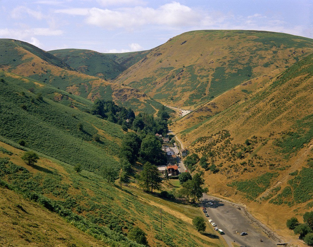
| Caption: | Burway Hill, Long Mynd. Looking NW. |
| Description: | Burway Hill, Long Mynd. Looking NW. Cardingmill Valley, Church Stretton. The Cardingmill Valley is one of a number of steep-sided valleys, or 'batches', on the eastern side of the Long Mynd. The valley sides display a sequence through the Precambrian (Longmyndian) Stretton Series rocks, which have a very steep westerly dip. The slopes nearest the camera are in the shales and sandstones of the Burway Group, succeeded by the purple shales of the Synalds Group. In the upper part of the latter group are the Batch Volcanics, exposed in the crags on the prominent spur in the middle distance. Beyond the spur the greenish siltstones and sandstones of the Lightspout and Portway Groups extend to the skyline. |
| Date taken: | Wed Jan 01 00:00:00 GMT 1969 |
| Photographer: | Pulsford, J.M. |
| Copyright statement: | NERC |
| Acknowledgment: | This image was digitized with grant-in-aid from JIDI the JISC Image Digitization Initiative |
| X longitude/easting: | 344500 |
| Y latitude/northing: | 294500 |
| Coordinate reference system, ESPG code: | 27700 (OSGB 1936 / British National Grid) |
| Orientation: | Landscape |
| Size: | 335.13 KB; 1000 x 790 pixels; 85 x 67 mm (print at 300 DPI); 265 x 209 mm (screen at 96 DPI); |
| Average Rating: | Not yet rated |
| Categories: | Unsorted Images, Geoscience subjects/ Landforms, river/ Valleys |
Loading...
Loading...
Reviews
There is currently no feedback