| P number: | P204624 |
|---|---|
| Old photograph number: | A04676 |
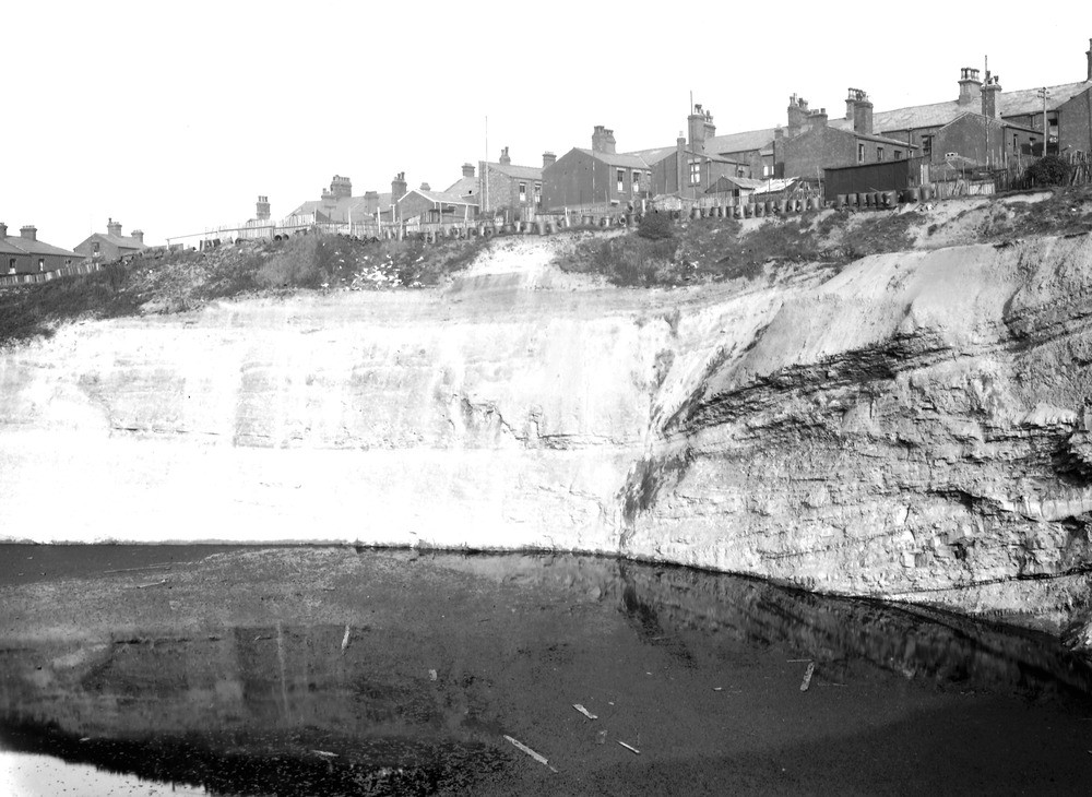
| Caption: | Doulton's Delf Pit, Boundary Road, St. Helens. Looking SE. |
| Description: | Doulton's Delf Pit, Boundary Road, St. Helens. Looking SE. Middle Coal Measures. Formerly worked for drain-pipes. Cross-bedded shale and occasional sandstone band. Dip 15 degrees east-south-east. Horizon between Rushy Park and Flaggy Delf Mines. |
| Date taken: | Mon Jul 01 00:00:00 BST 1929 |
| Photographer: | Rhodes, J. |
| Copyright statement: | Crown |
| X longitude/easting: | 350500 |
| Y latitude/northing: | 395500 |
| Coordinate reference system, ESPG code: | 27700 (OSGB 1936 / British National Grid) |
| Orientation: | Landscape |
| Size: | 214.11 KB; 1000 x 730 pixels; 85 x 62 mm (print at 300 DPI); 265 x 193 mm (screen at 96 DPI); |
| Average Rating: | Not yet rated |
| Categories: | Unsorted Images |
Loading...
Loading...
Reviews
There is currently no feedback