| P number: | P204554 |
|---|---|
| Old photograph number: | A04606 |
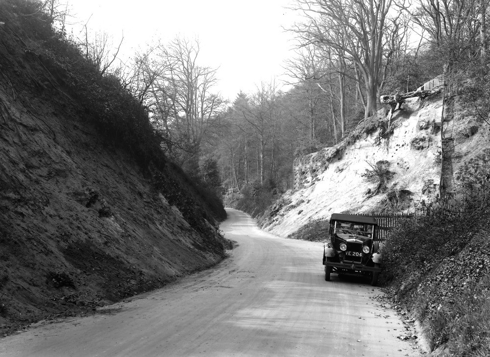
| Caption: | Dorking, 1 m. SE of town. Looking NNW. |
| Description: | Dorking, 1 m. SE of town. Looking NNW. Sunken road in Hythe Beds. Sunken roads of this type are of frequent occurrence in Lower Greensand districts, and are due to erosion: an early track along the line of which the unconsolidated material of the Lower Greensand beds, unprotected by vegetation, and loosened at the surface by foot and wheeled traffic is rapidly removed by the agents of sub-aerial denudation. |
| Date taken: | Wed May 01 00:00:00 BST 1929 |
| Photographer: | Rhodes, J. |
| Copyright statement: | Crown |
| X longitude/easting: | 517500 |
| Y latitude/northing: | 148500 |
| Coordinate reference system, ESPG code: | 27700 (OSGB 1936 / British National Grid) |
| Orientation: | Landscape |
| Size: | 288.49 KB; 1000 x 729 pixels; 85 x 62 mm (print at 300 DPI); 265 x 193 mm (screen at 96 DPI); |
| Average Rating: | Not yet rated |
| Categories: | Unsorted Images, Geoscience subjects/ General views/ Sand, sandstone and grit country, Geoscience subjects/ Archaeology and early history |
Loading...
Loading...
Reviews
There is currently no feedback